Antarctica with ANDRILL 2006
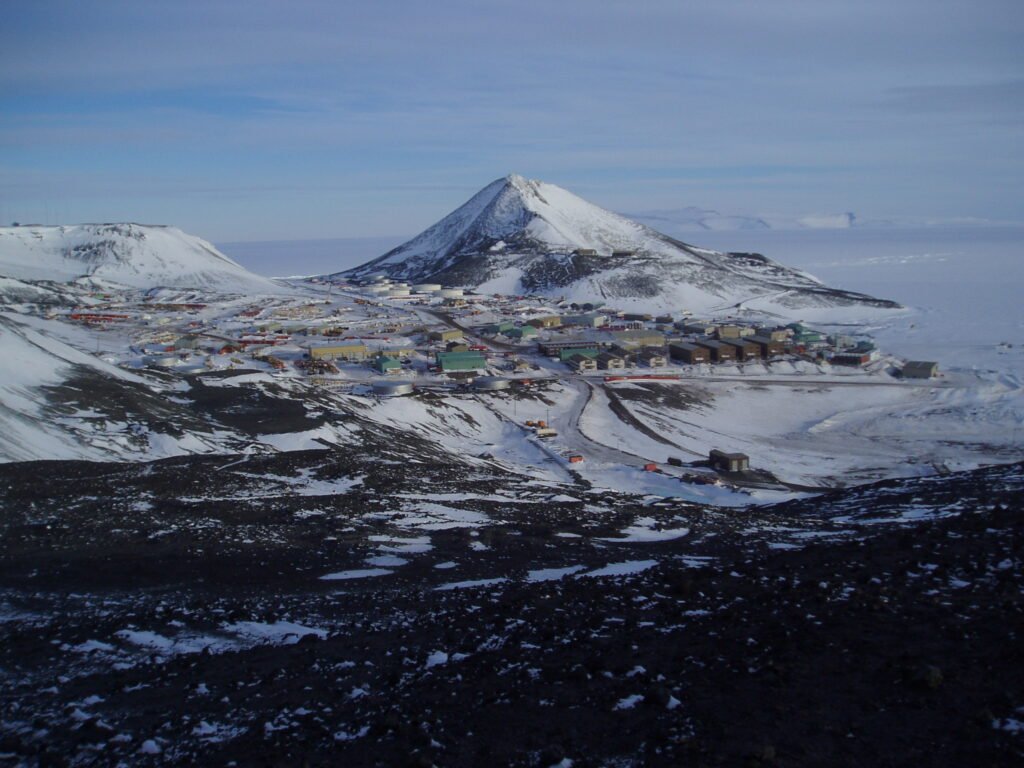
In late 2006 I was back in Antarctica again with the ANDRILL programme, but this time as an outreach educator along with 5 other teachers – 3 from the US, one from Germany and one from Italy. Over the two and a half month project we were based at McMurdo Station rather than Scott Base.
Our job was to be immersed in the different scientific disciplines involved in the analyses of the sediment cores that were being drilled up from the sea floor under the Ross Ice Shelf.
These included physical properties, macro and micro paleontology, paleomagnetism, clast analyses, mineralogy, dating methods, core logging, and other activities. In this way we gained an overall understanding of scientific drilling and how it allows understanding of past environmental changes in Antarctica. We then worked creatively to communicate the science to schools and the public in our home countries via blogs, videos, live calls and publications such as classroom resources.

The first step was to actually retrieve drill cores from the sea floor. This was an impressive feat as the drill rig was sitting on an 80m thick floating ice shelf that was shifting slowly sideways about a metre a day. Below the ice, and about 800m of sea water below that, was the seabed that was the target of the drill.
The drill had a hollow barrel so that as it cut down into the bedrock, it captured a cylinder of rock up to about 6 metres in length. This would then be winched up to the surface before the drill was lowered back to the sea floor again for further drilling.

The fresh cores were cleaned, put through some scanners to measure some physical properties and then bagged in 1 m lengths to be transported to the Crary Lab at McMurdo Station. This was where the main analyses of the cores happened
The photo was taken at the drill site, where we were collecting some new cores for transport to the lab.
By the end of the project 1284.87m of rock core had been recovered.

In this image you can see that the core has been sliced in half along its length and displayed on a long table in the laboratory. Half of the core is stored away as an untouched archive for future research, while the remaining half is used for sampling. The little flags on tooth picks indicate sampling points and the sampling bags are already labelled, ready to receive the samples.
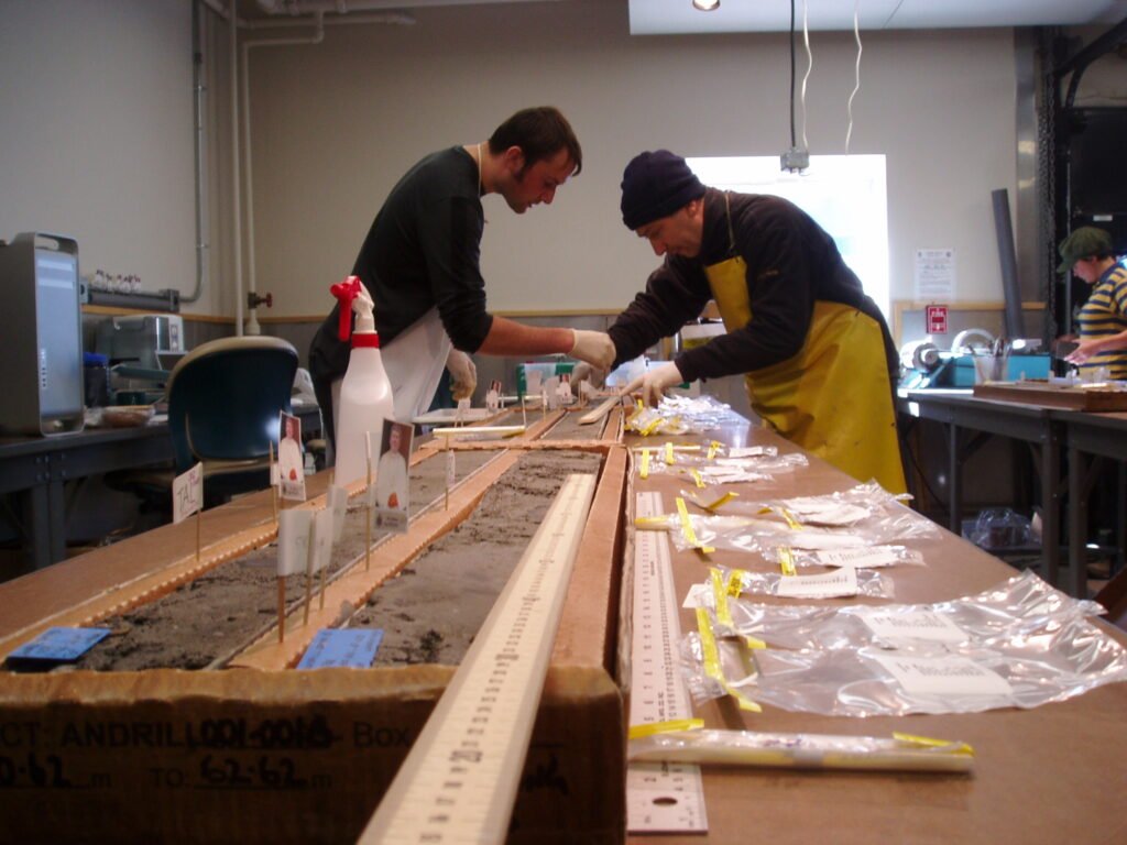
In this photo, small samples of the core are being taken to look at the diatom content. These single celled plant remains give information about the environmental conditions as well as the age of the core.
So how is it that the changing climate has left records of its history in the sediments underlying the ice shelf? To get a basic idea we will start with an imaginary cross section through the ice shelf in the next diagram below:

The ice is sliding off the mainland into the ocean and starts to float as a single huge slab, gradually thinning due to the erosive effect of the sea water underneath it, until it finally breaks up into icebergs.
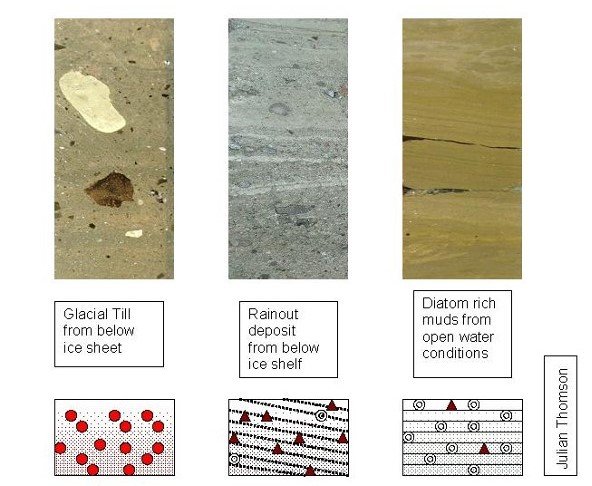
The ice is loaded with eroded rocks, particularly at its base (glacial till). Whilst it is still grounded, it bulldozes the basal till along, to form a thick deposit of unsorted and mixed sized particles. You can see an example of what this sediment looks like on the bottom left of the diagram.
Once the ice starts to float at the ‘grounding line’ it drops more rocks as it gets eroded from below by the sea water. This creates a layered ‘rainout’ deposit underneath the ice shelf (example bottom centre).
Finally the ice has broken up or melted away and there is open ocean above the sea bed. Apart from occasional rocks that fall out of passing icebergs (drop stones), the sediment is made up almost entirely of the skeletons of diatoms which are single celled algae.
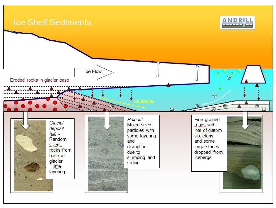
So now you can see how three different types of deposit have been created according to whether they came from underneath grounded glacier ice, and ice shelf or the open ocean.
At the location of the drill site, all three of these rock types were retrieved in the drill cores that were pulled up from the sea floor. This showed that cold conditions (where grounded glacier ice had moved into the area) alternated with warmer conditions when the ice was a floating ice shelf, and occasions where there was no ice at all, and diatoms were deposited instead of glacial gravels.
By studying and dating the advances and retreats of the ice shelf over the drill site, the project determined that there had been over 60 advances and retreats over a time span going back to about 13.5 million years ago.
Being part of an antarctic scientific drilling programme was an incredible learning opportunity that really opened my eyes to the ingenuity and applied technological brilliance of the scientific process.
The power of science lies in the combined talent of highly trained people who specialise in different disciplines and work together to problem-solve ways to make the observations they seek. They then pool their experience to arrive at understanding of extremely complex natural processes. In the case of climate research, this understanding of past changes clarifies the range and scale of possible future climate impacts.
Other highlights for me were numerous short trips away from McMurdo Station into the surrounding area via hikes, skiing and even mountain biking.
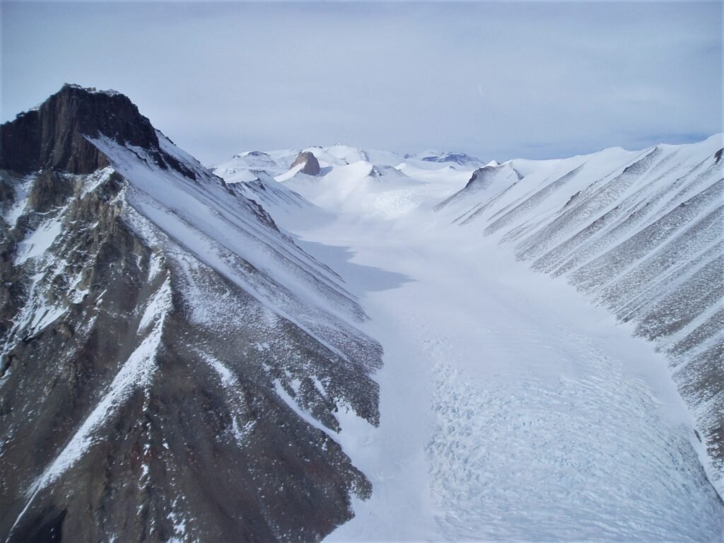
This photo is one that I took from a helicopter flight over the Transantarctic Mountains.
