From 1994 to 2008 I was employed as a high school science and outdoor education teacher at Raphael House Rudolf Steiner school in Lower Hutt, near to Wellington City. Around 2000, I began a collaboration with Uwe Morgenstern, a research physicist at GNS Science. He was doing quite a lot of fieldwork in the Southern Alps and we arranged that I would train secondary students to be field assistants for his expeditions.
Uwe’s specialisation is measuring the presence of the radioactive Tritium isotope for dating groundwater and glacier ice. He has developed the most accurate tritium dating lab in the world. With his technique he collected ice samples from glaciers in order to age date them with great accuracy. This required ice sampling trips, and also radar surveys to better understand the glaciers
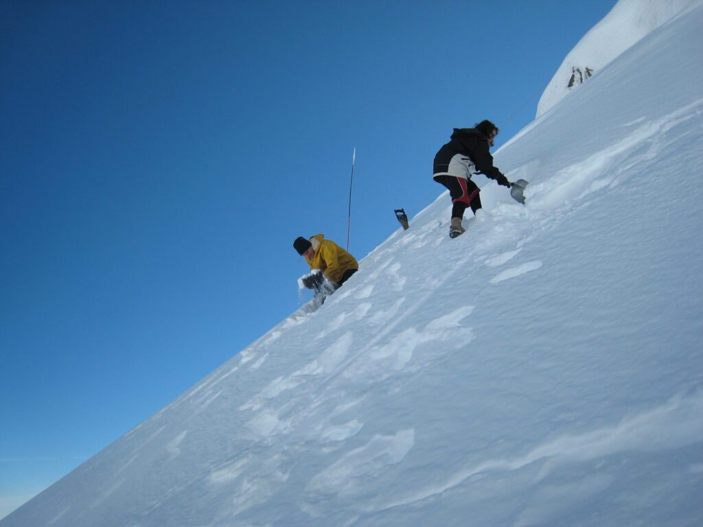
The school students who wanted to participate had to go through some training in alpine climbing and survival techniques. Part of this was to create a snow cave and spend the night in it, as well as learning how to move safely with crampons and ice axe.
In this image, two students are just starting to dig into the snow at two points to create their accomodation for the night.
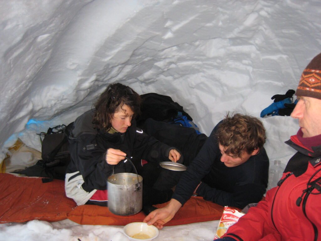
Cooking up an evening meal inside the snow cave. A well made cave is very comfortable even if a storm is raging outside.
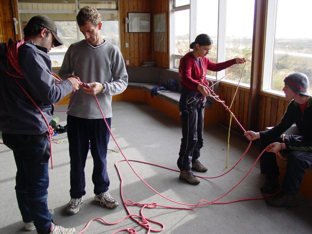
When it was time for the expedition, we travelled down to Mount Cook village. Before leaving for the mountain, we stayed in the Unwin Hut, belonging to the New Zealand Alpine Club.
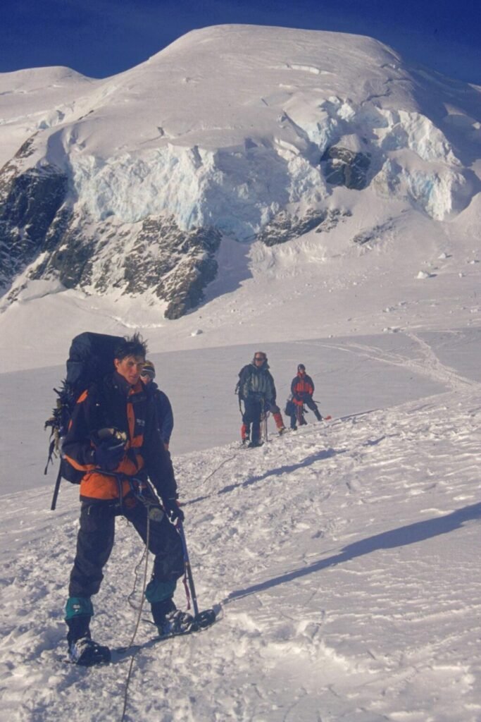
In this photo the students are going over the method for roping up when on a glacier.
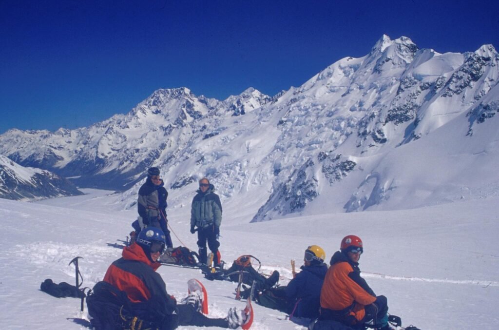
On our first trip to the head of the Tasman Glacier we did a radar survey across the different snow basins. We were able to find out that the ice was around 100 to 120m thick in this area.
The radar team at the end of a long day on the glacier. The mountain in the background is Hochstetter Dome.
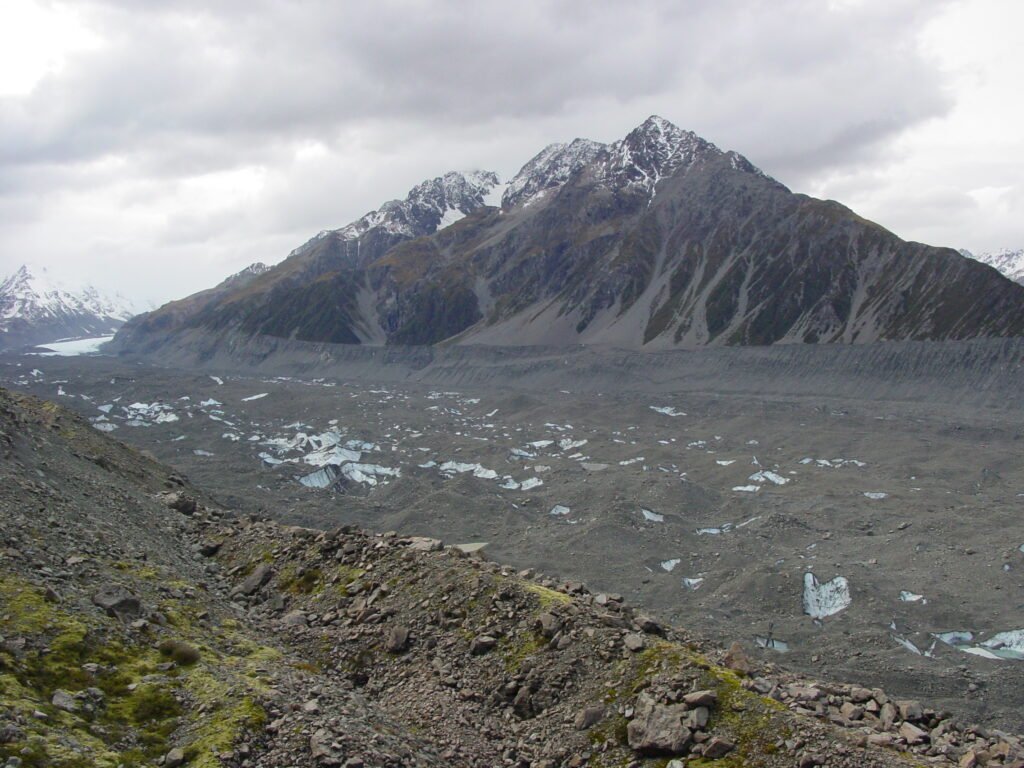
This image shows the lower part of the Tasman Glacier. Here it is almost completely covered with rock debris. You can see the white ice in the far distance to the left, marking roughly the half way point along the glacier.
The rock debris tends to gather on the surface as the surrounding ice melts away in the warmer temperatures at the lower elevations. If the debris is a very thin layer (under about 10cm thick) the darker colour of the rock vs ice, absorbs the sun’s energy, increasing the melting of the ice just below. However if the debris is thicker, it acts as a protective insulator, preventing the sun from melting the ice so quickly.
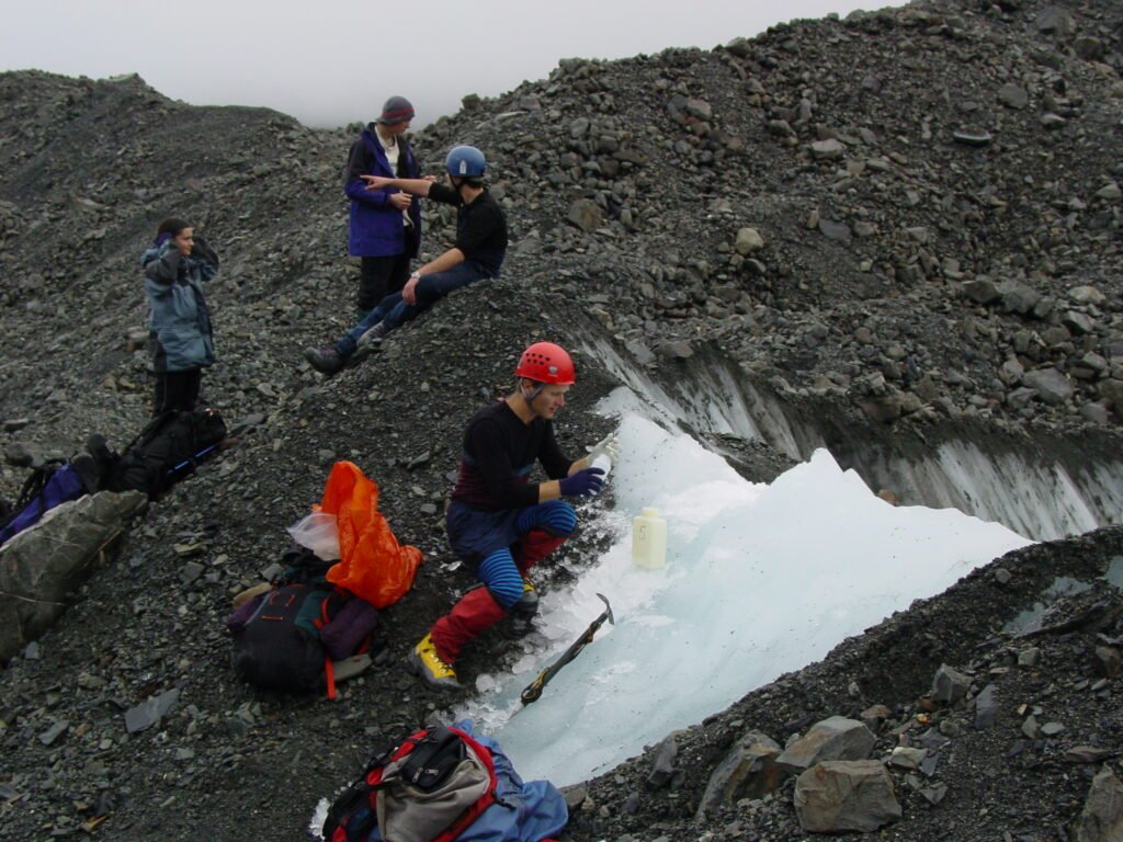
It is hard work hiking on the glacier debris. The glacier is about 2km wide in the central section, and it can take hours to find good sites for collecting ice samples.
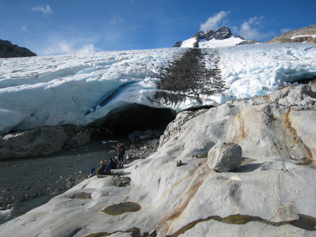
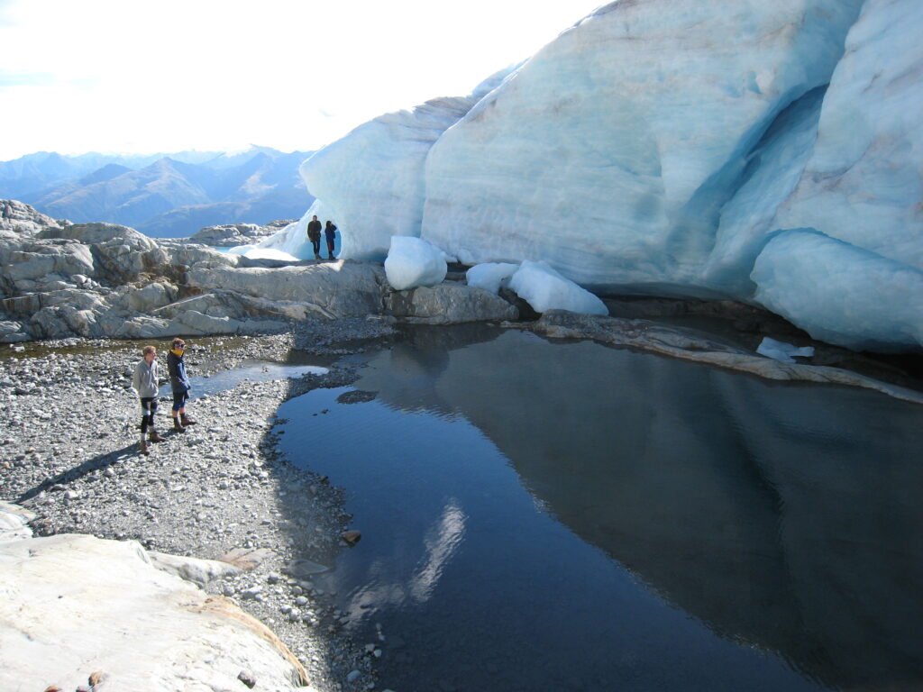
These expeditions became a fixture over a few years. On one of our trips we also visited the West Coast. This photo shows the terminal face and ice cave of the Brewster Glacier, near Haast Pass in 2009.
Another view of the terminal face of the Brewster Glacier. I have visited this glacier several times and like the other glaciers in New Zealand it has retreated dramatically over recent years.
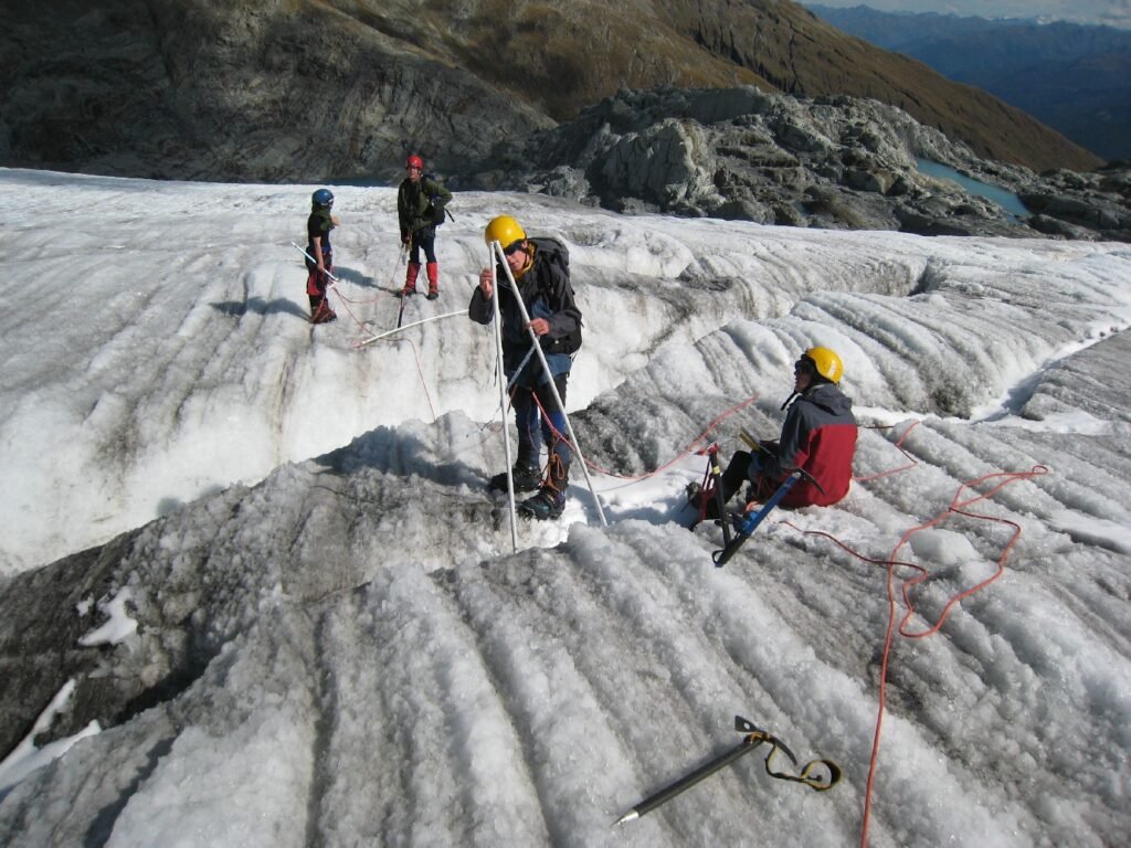
A way to measure how much a glacier melts over the summer months is to put vertical ablation stakes down into them at the start of the summer (Nov). At the end of the summer (March) we can then measure how much of the stake is exposed due to melting of the surface. This is usually done at several points over the glacier surface (Brewster Glacier example).
On this occasion, most of the glacier surface had lost over 5 metres of ice due to melting over the summer months.
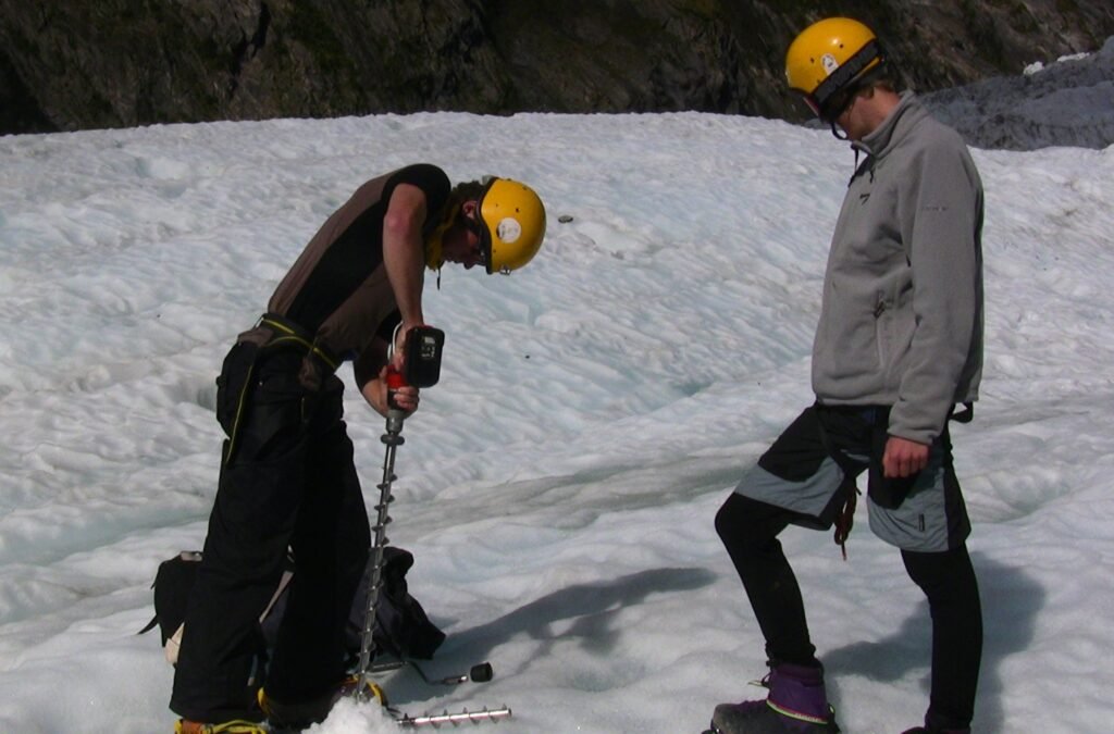
Here is a view of some students at work on the Franz Josef glacier. They are checking the ablation stakes and replacing them where they are nearly melted out of the ice.
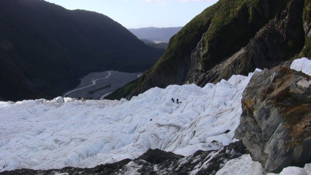
The Franz Josef glacier, like its neighbour the Fox, is extremely sensitive to changes in temperature and precipitation. This is because the accumulation zone is very extensive, snow precipitation is very high and the glacier gets funneled rapidly down a very steep, narrow valley to the terminus area. This is at a very low altitude, therefore very warm and with extremely high melt rates.
A power drill is used to make the hole in the ice when we need to insert a new ablation stake.
By maintaining these projects over many years, the glaciologists have been able to increasingly understand the environmental conditions that cause glacial advance or retreat, and also make estimates of climate and temperature changes that have occurred over time going back many thousands of years. They can also make projections of future impacts of the warming climate on the glaciers of the Southern Alps.
This video shows some of the activities of our 2009 expedition to the Southern Alps: