 |
| J,.Thomson @ GNS Science |
On the ground in the Kaikoura Quake aftermath:
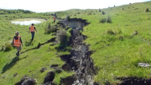
Following the recent M7.8 Kaikoura Earthquake, a number of teams of scientists have been deployed to survey the geological impacts and assess the
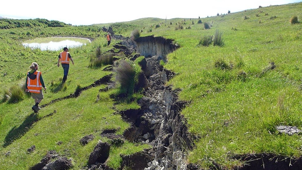
This gallery of images shows some of the numerous dramatic impacts of the quake in the coastal area to the north of Kaikoura.
 |
| J.Thomson @ GNS Science |
Accessing the area by road involves careful driving. The road surfaces next to many of the bridges have subsided, creating a crack at either end of the bridge:
 |
| J.Thomson @ GNS Science |
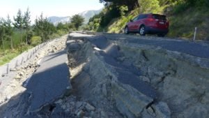
Slumping has occurred along parts of the highway:
 |
| J.Thomson @ GNS Science |
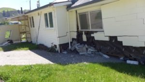
This photo shows the now famous house at Bluff Station that had the mis-fortune to be built directly on top of the Kekerengu Fault. The house was shunted about 7 metres sideways leaving some of its foundations behind.
 |
| J.Thomson @ GNS Science |
The house was pushed across its own driveway…
 |
| J.Thomson @ GNS Science |
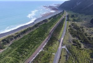
The coastal highway and railway have unfortunately been cut through in several places by fault ruptures. This view looking south at Waipapa Bay shows the northern branch of the Papatea Fault crossing SH1 and heading out to sea.
 |
| J.Thomson @ GNS Science |
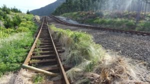
This is what the road now looks like on the ground. The fault scarp has been bulldozed to allow vehicle access.
 |
| J.Thomson @ GNS Science |
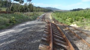
A short distance away, the railway line was lifted up and dropped in the grass next to its original gravel bedding.
 |
| J.Thomson @ GNS Science |
From the top of the fault rupture, you can see that the displaced railway tracks extend for about 300 metres into the distance.
 |
| Will Ries @ GNS Science |
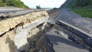
A few hundred metres further south, the southern branch of the Papatea Fault crosses the road and railway.
 |
| J.Thomson @ GNS Science |
The earthquake ripped right through the concrete culvert that ran under the road, and again lifted the railway off its bed.
 |
| J.Thomson @ GNS Science |
From the air, the scarp of the southern branch of the Papatea Fault is seen to extend like a knife-cut across the shore platform. In this image you can sea the uplifted coastline extending into the distance. The total uplift of the area left (east) of the fault is 5 to 6 metres, whilst the area to the right was uplifted by a smaller amount. Water has been ponded up against the new fault scarp.
 |
| J.Thomson @ GNS Science |
A helicopter view showing the scarp of the Papatea Fault close up (across the top of image). The fault movement is thought to have been mostly horizontal with about 2 metres of vertical uplift in addition.
 |
| J.Thomson @ GNS Science |
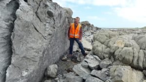
The Papatea Fault scarp is a sheer wall about 2 metres high.
 |
| J.Thomson @ GNS Science |
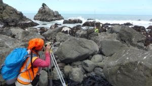
Part of the task for scientists is to measure the uplift along the coast. The high and low water marks make a useful reference point that can be surveyed against the new sea level positions.
 |
| J.Thomson @ GNS Science |
Sadly the raised shoreline stranded innumerable sea creatures that now litter the area amongst the seaweed.
 |
| J.Thomson @ GNS Science |
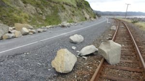
Rockfalls have been numerous, and have caused a lot of damage where the road and railway are squeezed up close to the coastal cliffs.
 |
| J.Thomson @ GNS Science |
The end of the road? The reason why you won’t be travelling into Kaikoura from the north anytime soon. This rockfall is at the south end of Okiwi Bay, and there are more slips like this further south.
There are several GeoTrip locations that you can visit to see the changed landscape along the Kaikoura Coast such as this one

Stunning photos Julian! One of the lessons of this for me is the idea of a point epicentre with concentric rings of energy decreasing by the inverse square rule goes out the window when multiple faults rupture for hundreds of km.
Fascinating photos. So glad I subscribed to this blog just a couple of months ago.
[Valerie]
Well you never know what nature have for you and this landscape looks very unique and I would love to see it.
The power of mother nature is incredible, stunning images and really good information. I saw some of the videos and drone shots on YouTube as well.
This comment has been removed by a blog administrator.
Beautiful places to visit for but earth quake really has destroyed many of them. This is a major drastic it might have interepted the local as well as tourism. I hope they fix it soon.
This comment has been removed by the author.