Last weekend I went to camp and tramp in the Tama Lakes area on the saddle between Ruapehu and Ngauruhoe.
These lakes were created by several explosion craters within the last ten thousand years giving them a circular or crescent form. The landscape is covered with blocks of lava and scoria as well as some fine ash remaining from Ruapehu’s 1995 – 1996 eruptions.
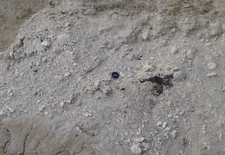
There are also some layers of pumice from the huge Taupo eruption about 1800 years ago. This photo shows some charcoal fragments – remains of some of the vegetation that was scorched during the most violent eruption on earth in the last 5000 years.
The lower Tama lake is being slowly filled up by a river bringing in eroded ash and other volcanic debris from the surrounding area. You can see this delta on the far side of the lake in the image. Beyond it is a similar adjacent (sediment filled) crater of about the same size. The water is very clean and drinkable, and yes – it really was that blue!
I set up my tent in a little hollow, sheltered from the wind and on a nice flat spot.
The view north from my campsite shows the Upper Tama lake and the south face of Ngauruhoe, my planned hike for the next day.


Hi Julian
thanks for your report. You mentioned that water from the lower lake was drinkable. What about Upper Tama lake and the little tarn just north-east of it? Would you happen to know if that water is potable?
Thanks
Dennis