
 The Alpine Fault has been the focus of a lot of research over recent years, including the Deep Fault Drilling Project, Alpine Lake Sediment Research and the Earthquake Records at Hokuri Creek amongst them. These are building a much clearer picture of the history of previous fault ruptures, and allowing better estimates of the size and likelihood of future earthquakes.
The Alpine Fault is a long, straight, geologically fast moving fault that typically produces very large earthquakes rupturing along large segments of its total length.
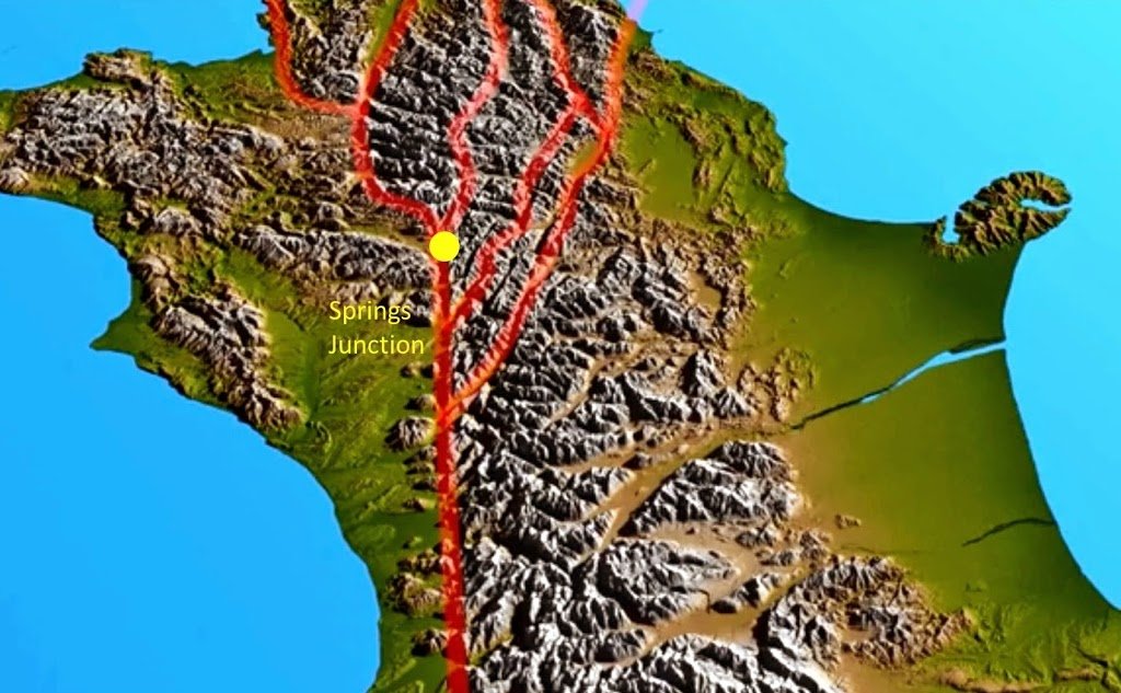
At its northern end the Alpine Fault branches into a number of different faults that cross Marlborough and are known as the Marlborough Fault System. This means that here the Alpine Fault only takes up a proportion of the total displacements in this region and is likely to have a different earthquake history compared to the
central and southern parts of the fault.
Recently a GNS Science expedition to the northern part of the Alpine Fault near Springs Junction, involved digging two trenches across it to better understand its local earthquake history through some careful investigation. This location features as one of our GeoTrips that you can visit. www.geotrips.org.nz/trip.html?id=59 .

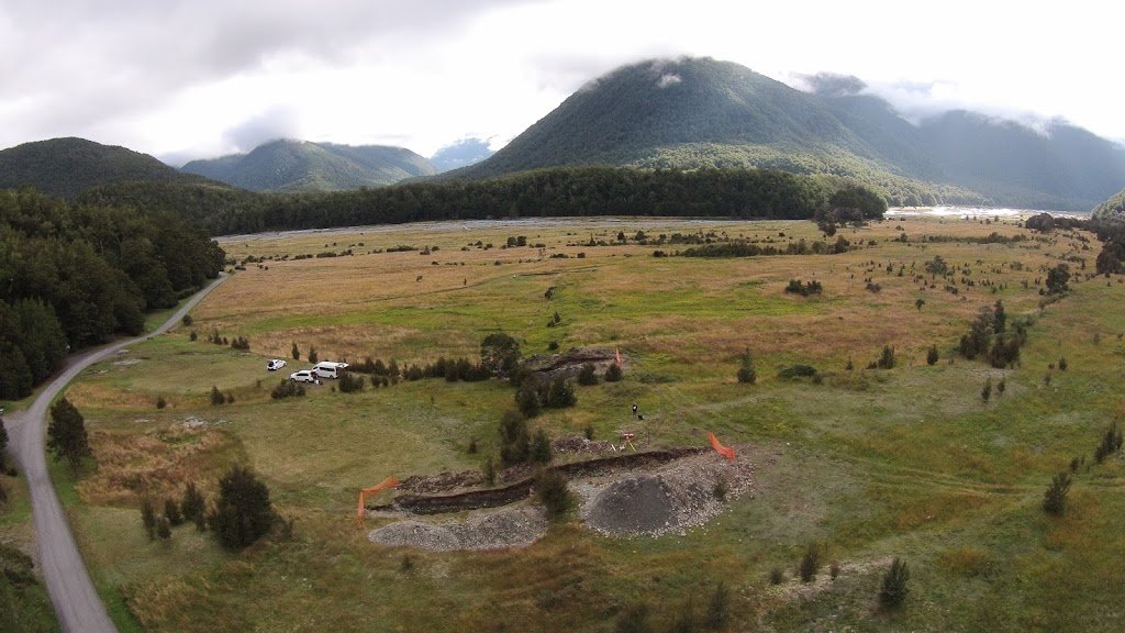
This image shows the trenches (left of centre foreground) from the air. The trace of the Alpine Fault passes through the trenches and into the distance between the hills.

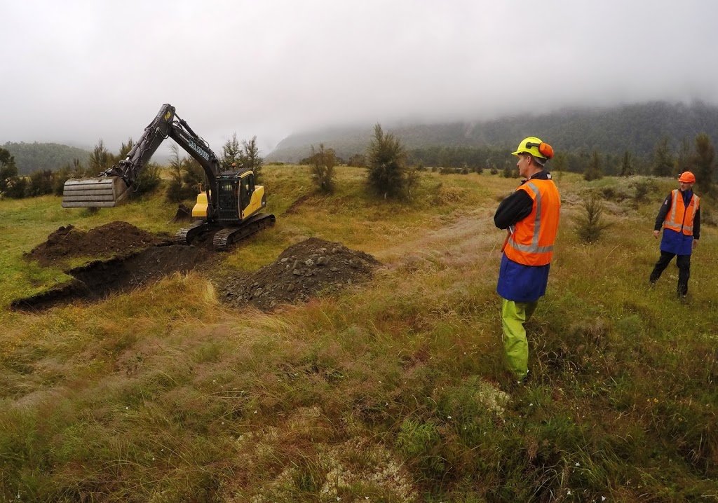
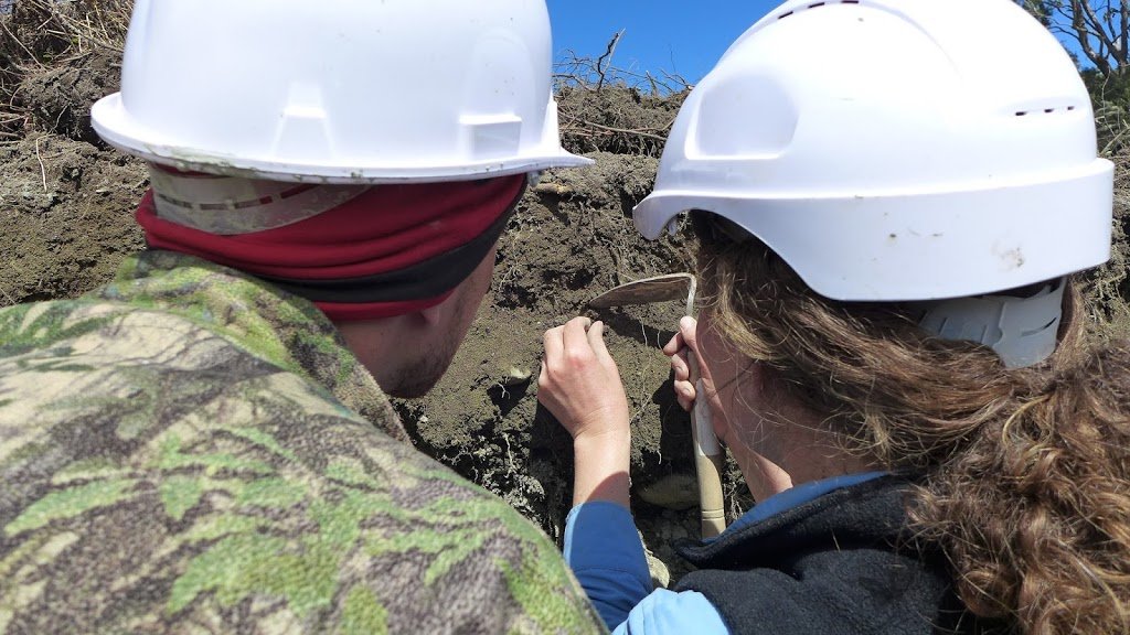
Once the trench has been dug out, the walls need to be cleaned up carefully so that the fine detail of the different sediments and structures can be observed and recorded.

A string grid is pinned against the walls of each trench to help map them out, and markers are placed to highlight significant features that can sometimes be very hard to discern. The leader of this project is Rob Langridge, shown here having a close look at the detail.

Many hours are spent drawing accurate maps of the trench walls as well as taking high resolution panoramic images of them. These are taken in order to document the excavation so that later interpretation of the data can continue once the trench has been filled up and the team has returned to the office.

This image shows the Alpine Fault in section with the line of the fault shown. The scarp or slope at the ground surface has been produced by earthquakes uplifting the left hand (eastern) side.
You can also see the effect of fault movements on the river sediments below the ground. The grey clay layer on the left has been cut off at the fault and the overlying gravel layer has been dragged out of shape by repeated fault movements.
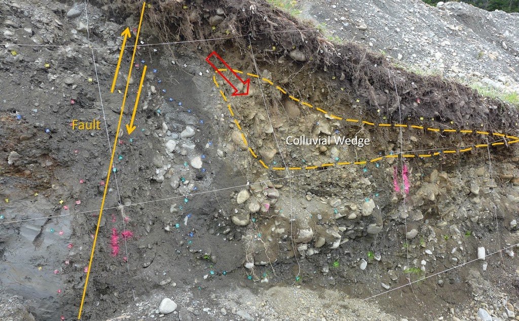
This is a close up view showing the complexity of the sediments and structures close to the fault. When earthquakes uplift ground on the left side of the fault, loose material at the surface collapses across the fault and forms a wedge shaped pile of sediment on the ground called a colluvial wedge.These earthquake associated layers later get buried by younger material. They can be very hard to identify, but are a critical record of past ruptures. They can form repeatedly, so that wedges from earlier earthquakes may have more recent colluvium laid over the top of them.
Once the colluvial wedges have been identified, the next step is to look for plant or animal material that has been trapped in them at the time they were created. These carbon rich specimens are carefully collected for dating in the lab using the radiocarbon dating method. (See below for a video that explains carbon dating)

When a major fault ruptures during an earthquake, it can branch out near the ground surface to produce a number of smaller faults close to the main fracture. Here is an example that showed up in the trench wall a few metres from the main fault. The layers on the right have been pushed up relative to those on the left. By carefully observing which layers have, or have not been affected by these secondary faults, the earthquake record can be further clarified.

Once all the data and specimens have been gathered and logged, the trenches are filled in once more so that the surface can revegetate back to its original state.
Here is a 3 minute video of the project:
And this video explains radiocarbon dating:
Finally click here for the TVNZ news report on the trenching.
NICE