 Whilst those of us in Wellington may have felt a short jolt and a bit of a wobble, the 7.1 magnitude earthquake hitting Christchurch on Saturday morning was an altogether different experience for the locals. People I have talked to referred to the noise of the quake as being one of the most powerful aspects of the experience.
Different specialist teams from GNS Science immediately leapt into action to capture vital information about the origin and effects of the quake, and to keep authorities, public and news media updated. Web traffic has been very high with the GeoNet website receiving 15 to 20 million hits per day.
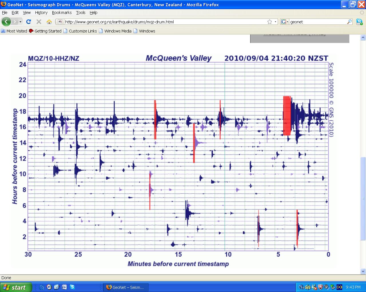
This image is the seismic drum for McQueen’s Valley, near Christchurch on the Saturday afternoon. You can see how the aftershocks are very frequent. Some of them are up to magnitude 5.4, though scientists think a larger one of up to magnitude 6 is possible sometime in the next few days.
This seismic drum is from the same time, but recorded in the far north up at Waipu. You can see how the weaker ground shaking has not reached that far, but many of the aftershocks are still recorded there. It is interesting to look at the way the waveforms change when they are recorded a lot further away from the epicentre.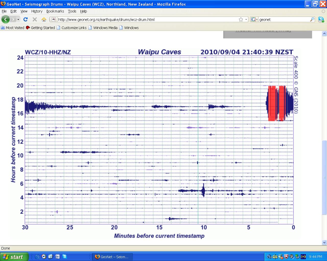
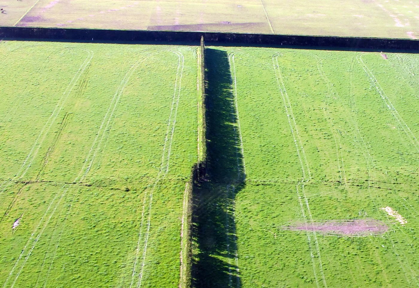
An initial flyover of the surface rupture revealed a fault trace about 22kms long in the Rolleston area to the west of Christchurch, with a maximum of 4 metres of horizontal and 1.5 metres vertical displacement. The surface rupture passed close by a few farm buildings and beneath two farm houses. The fault dislocated some hitherto undisturbed glacial river terraces, showing that it has not moved for a minimum of 16 – 18 000 years.
Here is a video of the fault trace from the air:
 The Geonet seismologists started the analysis of the large number of aftershocks detected by the NZ network of seismometers, finding their locations and magnitudes, and using the information to interpret crustal stress and strain dynamics in the region. The data collection systems were thoroughly tested and have performed very well through this event.
A team flew down to Canterbury and installed an array of extra seismometers which add further data as the aftershocks continue.
Other GNS Science teams are now in the Christchurch area assessing and monitoring such things as: infrastructure damage, including water and sewage, fault and landscape mapping, risk engineering, high resolution GPS measurements, and further measurements and mapping of ground motion.