 |
|
The Pink Terraces of Rotomahana before the Tarawera Eruption of 1886
(Permission of the Alexander Turnbull Library, Wellington, New Zealand, must be obtained before any re-use of this image). |
 |
| Devastation after the Tarawera eruption |
 |
| Dan Fornari of WHOI |
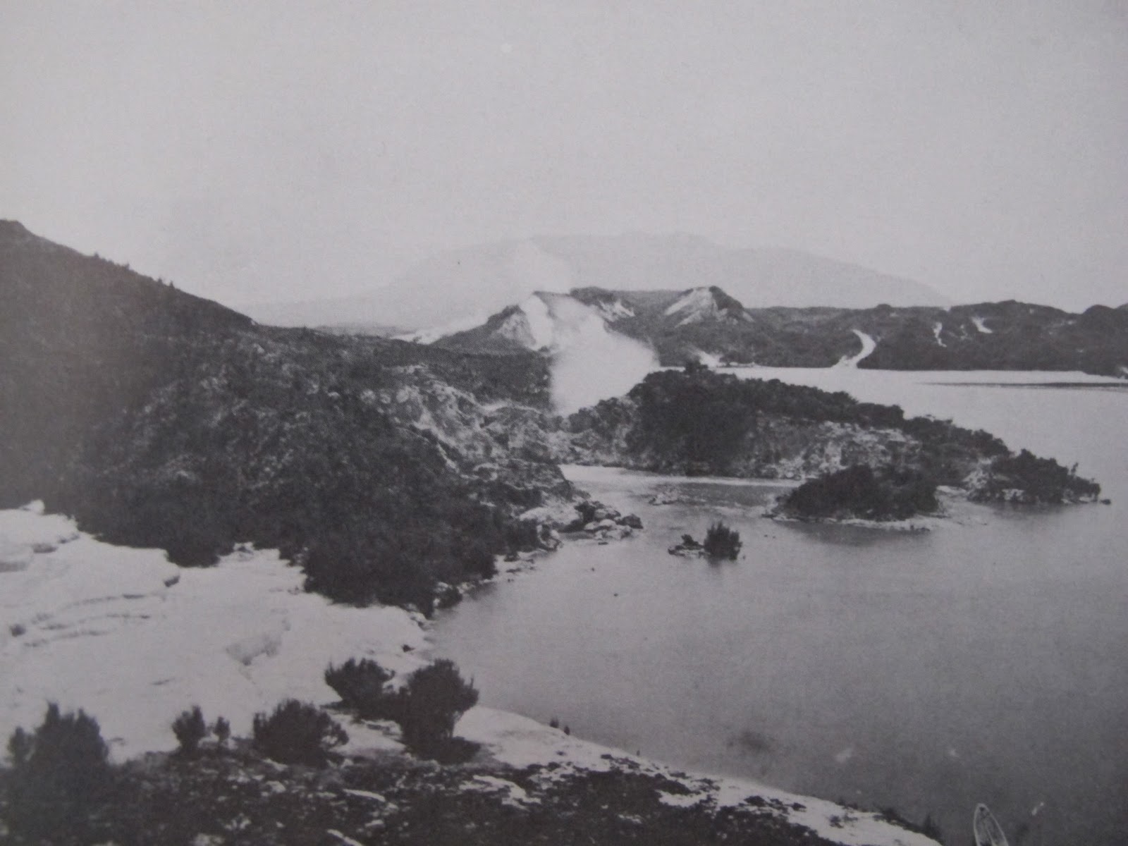 This early, pre-eruption photo of the lake shows the Pink Terraces on the left. In the middle distance you can see a hooked spit of land extending into the lake as a very distinct feature. This gives the lake shore a very identifiable contour just northeast of the Pink Terraces.
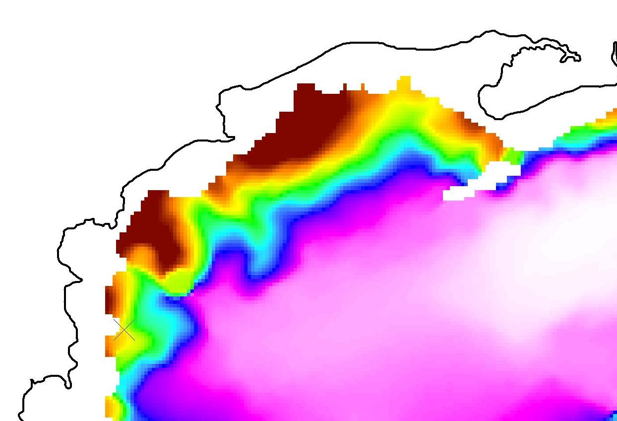
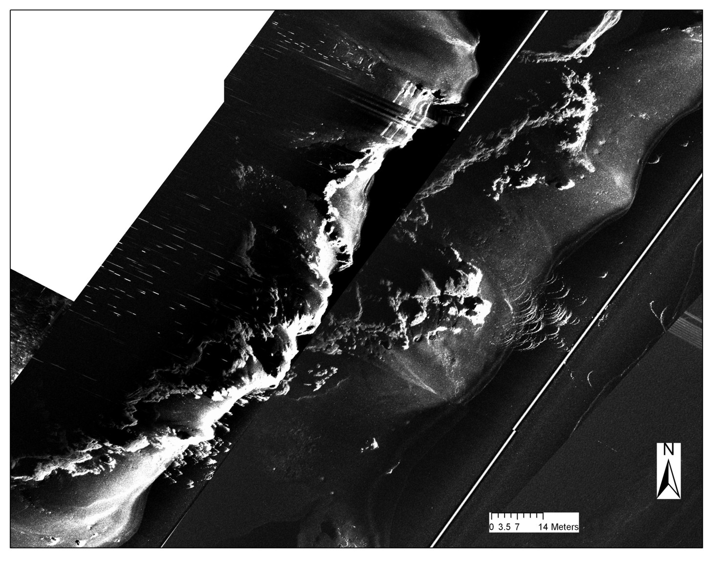
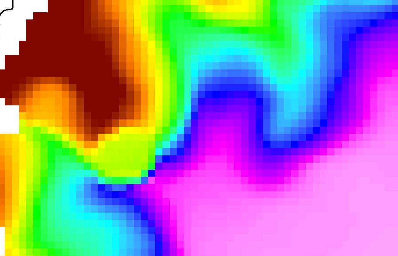
In the compiled bathymetric map produced by Vicki from the AUV survey data, the same hooked-shaped peninsular can be seen in the lake bed, now several tens of metres under water. This is in the northern section of Lake Rotomahana, in the area that has been indentified as the probable location of the Pink Terraces by previous researchers.
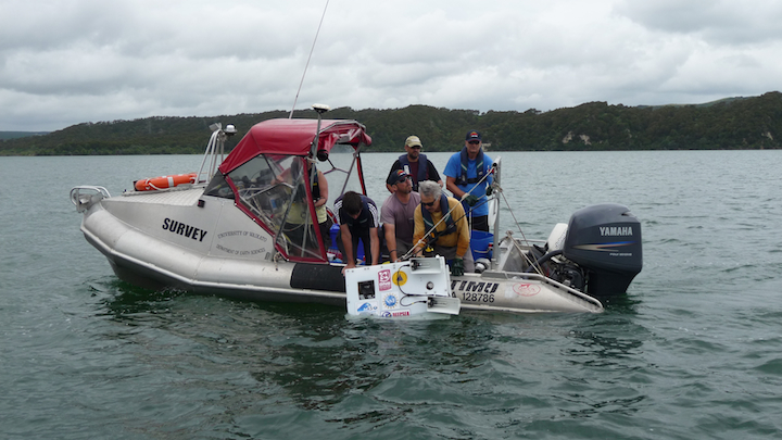 A further investigation was made by lowering an underwater camera, developed by Dr. Dan Fornari at WHOI, down to the bed of the lake to take a closer look. The following images are a selection from those taken.
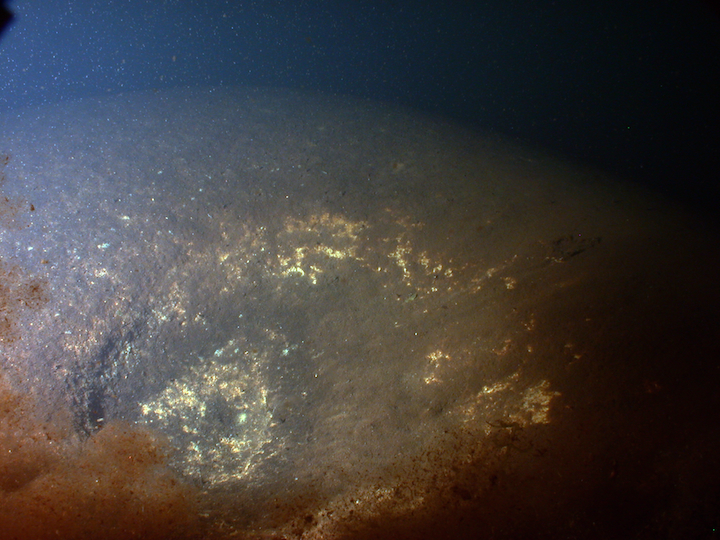
The first shows a small crater with a hazy cloud of bubbles and coming out of it. This depression is roughly a metre across. Because of disturbance caused by the high level of hydrothermal activity, the ranges of the camera images are only a few metres. *
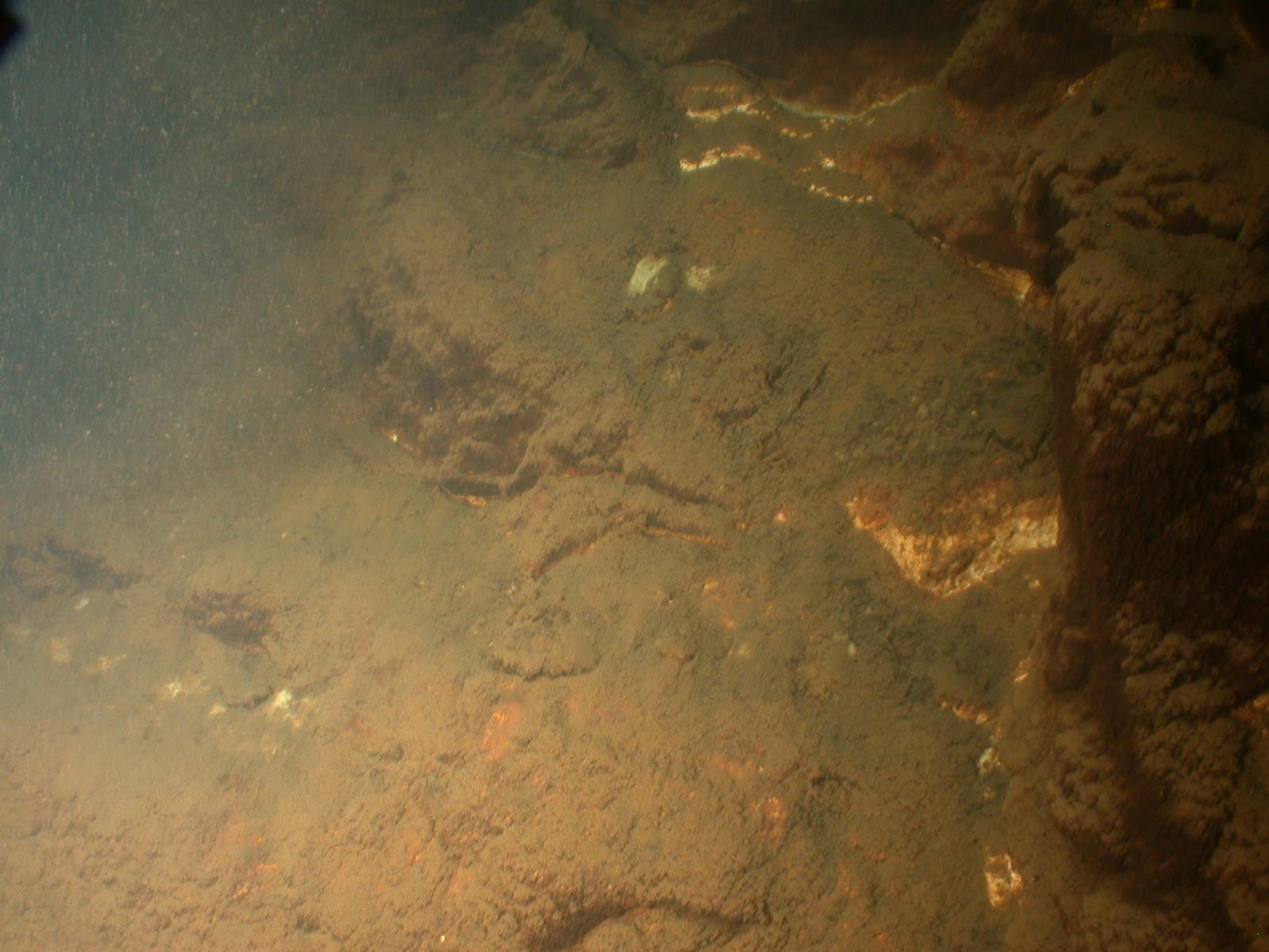
In the next photo you can see some vertical relief. On the right, the dark shadow is one of the terrace steps, whilst further to the left, across the sloping muddy lake floor there are some smaller exposed vertical sections of rock. These shapes are typical of hydrothermal silica deposits seen in other parts of the Rotorua geothermal area.*
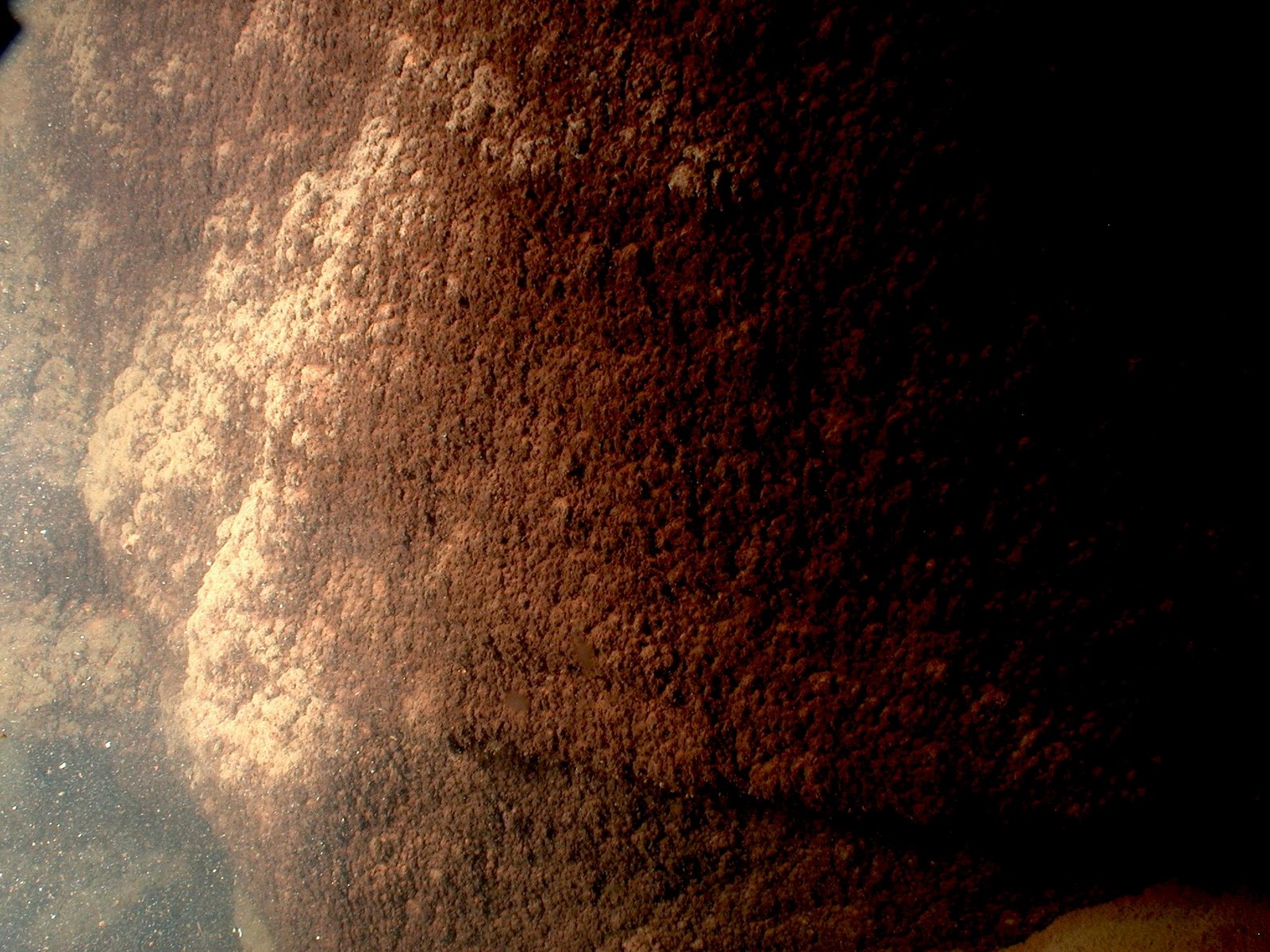
The last of the underwater photos, taken near the region identified by Vicki as being where the strong reflectors of the Pink Terraces are located, show the vertical edge of a terrace head on. The scaling is not exact but in the region of one or one and a half metres in height and could be an exposure of the lower part of the Pink Terraces. *

These initial findings leave many questions that can be followed up in the future. But for now, to know that at least a part of the Pink Terraces of Lake Rotomahana are still there, hidden in the depths of the water, is a fantastic outcome of the Lake Rotomahana Project. Quite apart from this discovery, the analysis of the overall expedition findings will give the scientists plenty to do towards the goal of understanding the whole hydrothermal system of Rotomahana. Dr. Cornel de Ronde, of GNS and leader of the expedition has something to smile about.
* “Digital underwater photographs taken by Dr. Dan Fornari – Woods Hole Oceanographic Institution (WHOI), Cape Cod, MA, USA, using equipment developed with funding from the US National Science Foundation and WHOI. Digital underwater camera developed by Mr. Mark Olsson of DeepSea Power & Light, San Diego, CA, USA. Copyright D. Fornari – Woods Hole Oceanographic Institution.”
My family and I have been watching your project with interest. Fantastic photos coming out from the underwater "torpedo" camera.
However, my 7 year old daughter asked some questions that I could not answer and I am hoping you can help. Original photos show the terraces on the edge of the lake but it is clear that they are now in the middle of lake at the bottom rather than on the side of the lake simply buried.
She wants to know why did the volcanic eruption also cause them to be "flooded" under the lake, rather than just covered with ash?
My answer was that it looked like the water table rose, she then wanted to know why a volcanic eruption caused the lake to rise. At this point I bow out as I have no idea and don't even know if this is correct. Was this caused by the eruption and if so are their some child friendly explanations or sites you can refer me to?
Keep up the great work!
it causes rupture for it to fall
A great question from a young scientist! The lake rose because the large amounts of ash and mud from the eruption blocked the outlet stream of the original lake. It took about 15 or more years for the new lake to fill up to its present level, thus flooding the terraces. I hope that helps!
Thanks Julian, a really simple explanation – makes perfect sense. Amazing that it took 15 years. Thanks for that.
Hi, I just wanted to know if it would be possible for other reminants of the terraces to exist under layers of mud on the surface?? And could they be uncovered or would it be dangerous to disturb the area?
Answer: Yes, it is quite possible that more of the terraces lie hidden under the mud. We do not yet know if any more of them could be uncovered, if they are indeed there.
Is it possible for the terraces to be brought to the surface (even if we have to drain the lake)
ANYMeans possible no matter what impact it will have
Is it possible for us to restore the terraces and bring them back to the surfaces (even if we have to drain the lake to original levels
what happens if u drain the lake and find u were wrong aye
wait what are u say
I think your avoiding the point i said "is it possible for the terraces to be brought back to the surface" I'm not really focused on if their there or not but mearly to find means of getting them back or to at least get a clear view of them.
Volcanic eruptions have become much less common now-a-days. I am sure that your investigation will bring new news to the world. These revelations will surely help in further investigations.