Today I have been in the Port Hills of Christchurch with Chris Massey, an engineering geologist in the GNS Science Active Landscapes team.
 Chris is part of a team undertaking a detailed study of the rockfalls that have been triggered in and around Christchurch as a result of the recent earthquakes. The aim of his research is to gather data from the recent rockfalls to map out the potential danger zones and quantify rockfall risk around the city. His research will help planners decide which areas will require mitigation of rockfall risk before rebuilding can occur.
We visited a few key localities which had suffered damage from rockfall during the February 22nd ‘quake.
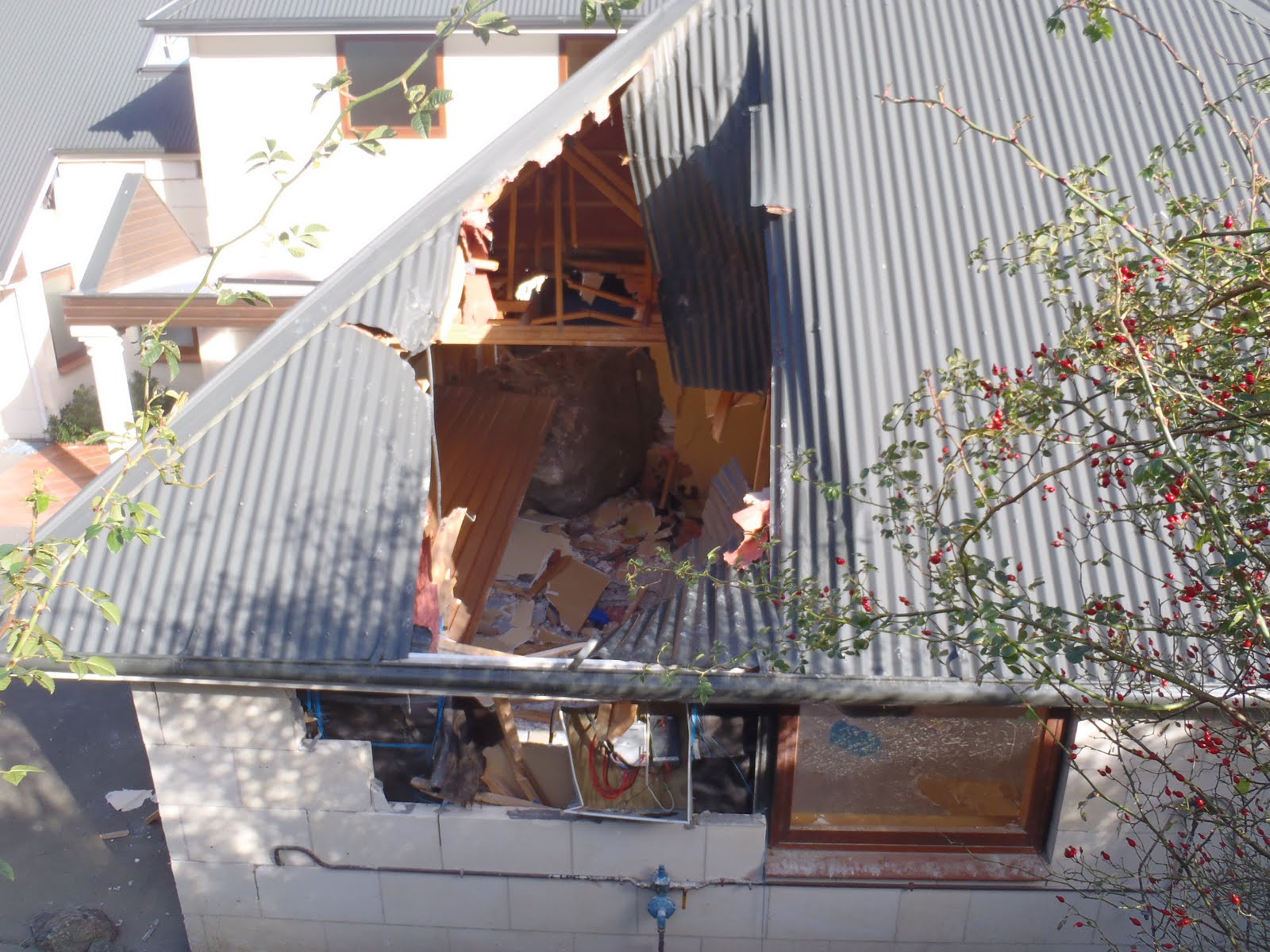
 This property in Heathcote suffered severe damage from a large boulder that travelled roughly 500 metres from the slopes above, bouncing tens of metres at a time, and clearing a 2 metre fence before entering the house through the garage roof. (Photo 1).
 Later in the day we joined Marty and Mike of Solutions 2 Access who are removing unstable boulders from Castle Rock, a popular climbers venue in the Port Hills. This outcrop was shaken and destabilised by the recent earthquakes, sending many boulders flying down slope towards the Lyttelton Road Tunnel entrance. Many other boulders were left precariously perched on the rock face, posing a risk to motorists on the road below, hikers and climbers. Marty and Mike have been contracted by Opus Consultants to remove these rocks which they do by levering them off with a crowbar or by other mechanical methods.(This is known as ‘rock popping’). In the second photo, Marty has just sent large boulder off the edge of the cliff.
Chris is interested in analysing the rock fall trajectories as part of the hazard mapping.work.
My job was to record video footage of the falling boulders as they were released from the cliff and hurtled down the slopes. This will improve our understanding of how the boulders travel, including their bounce heights, velocities and angular rotation, which is important when analysing their destructive potential. Here you can see the dent in the hillside caused by a flying boulder impacting on the surface.
 At the end of the day we went further along Summit Road to the area below the Gondola cable car. The road was covered with rockfall debris that had been shaken off the cliffs just above. The rocks had broken through the metal safety barrier, and some of them had travelled all the way down as far as the lower cable car station about 1 kilometre away.
 It was interesting to observe the impact craters in the road. The last photo shows a rock deeply embedded in the asphalt – a sobering impression of the power of a falling rock.
Check out the video of Chris’s rockfall research in Christchurch:
I am new to your blogs and am finding them really helpful and informative from a laywoman's perspective 🙂
Thanks so much and keep them coming!
Karen
Hi there, It's great to hear about the work being undertaken around rockfall impacts. We are up on the Murray Aynsley area on Stronsay Lane (just diagonally below the Rocky Point water Reservoir), there are obvious loose rocks around there, but not sure if anyone is looking at sorting these out yet, as everyone in our neighbourhood is frightened out of our wits in the area.. would be grateful if anyone knows? 🙁
It's wonderful to access useful information that is also so clearly communicated, thanks!
You're doing a terrific job of clearly sharing available knowledge, thank you! Unadorned, true communication like this is exactly what the region needs.
Awesome stuff Julian – and fun to run into your geo outreach again! Terry Wilson
Love the post Julian 🙂 Just to let you know that the link to the poster is no longer working.