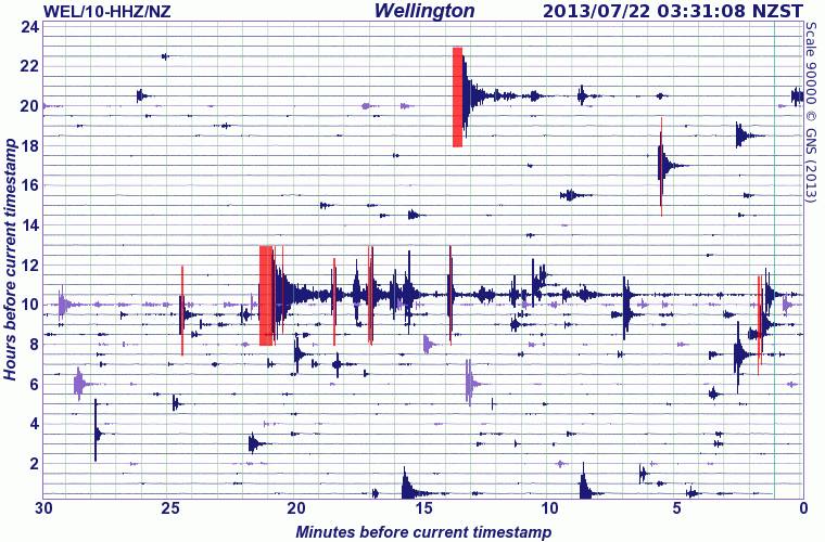
This is a screen shot of the Wellington seismometer from very early on Monday morning 22 July

Following the earthquakes in Cook Strait over the weekend, it was impressive to arrive at work on Monday morning, and watch how the GeoNet team, many of whom had been busy right through the weekend, were in full action mode again. Ken Gledhill, the head of GeoNet, co-ordinated two meetings of the scientists and technicians during the day.

There are lots of different things involved with understanding earthquakes. These include getting accurate locations and magnitudes, modelling the position and orientation of the fault and the type of fault rupture from the seismic wave patterns of the aftershocks, working out the adjusted stress on nearby active faults and then trying to calculate probabilities of future quakes to inform an ‘awakened’ public…
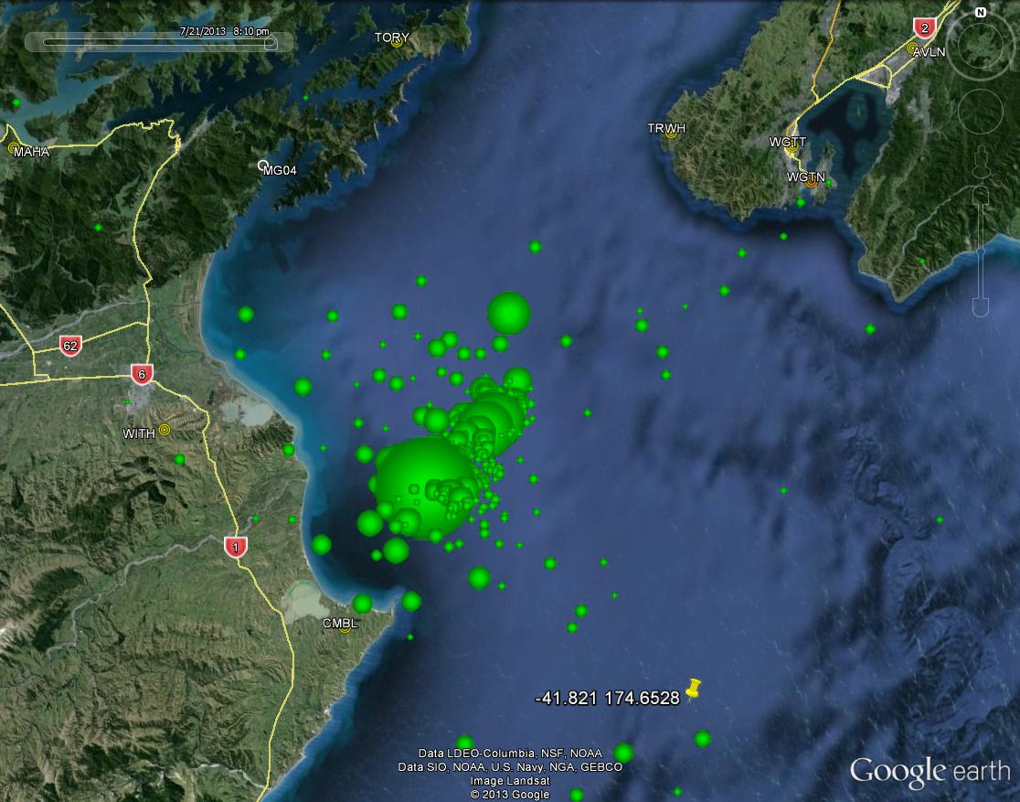
Here is the aftershock map from Sunday evening that shows the relative magnitudes of the quakes and their initial locations in 2 dimensions. Up to today there have been nearly one thousand aftershocks already. As more and more occur and get analysed, a more precise 3D image of the fault(s) involved will be built up.
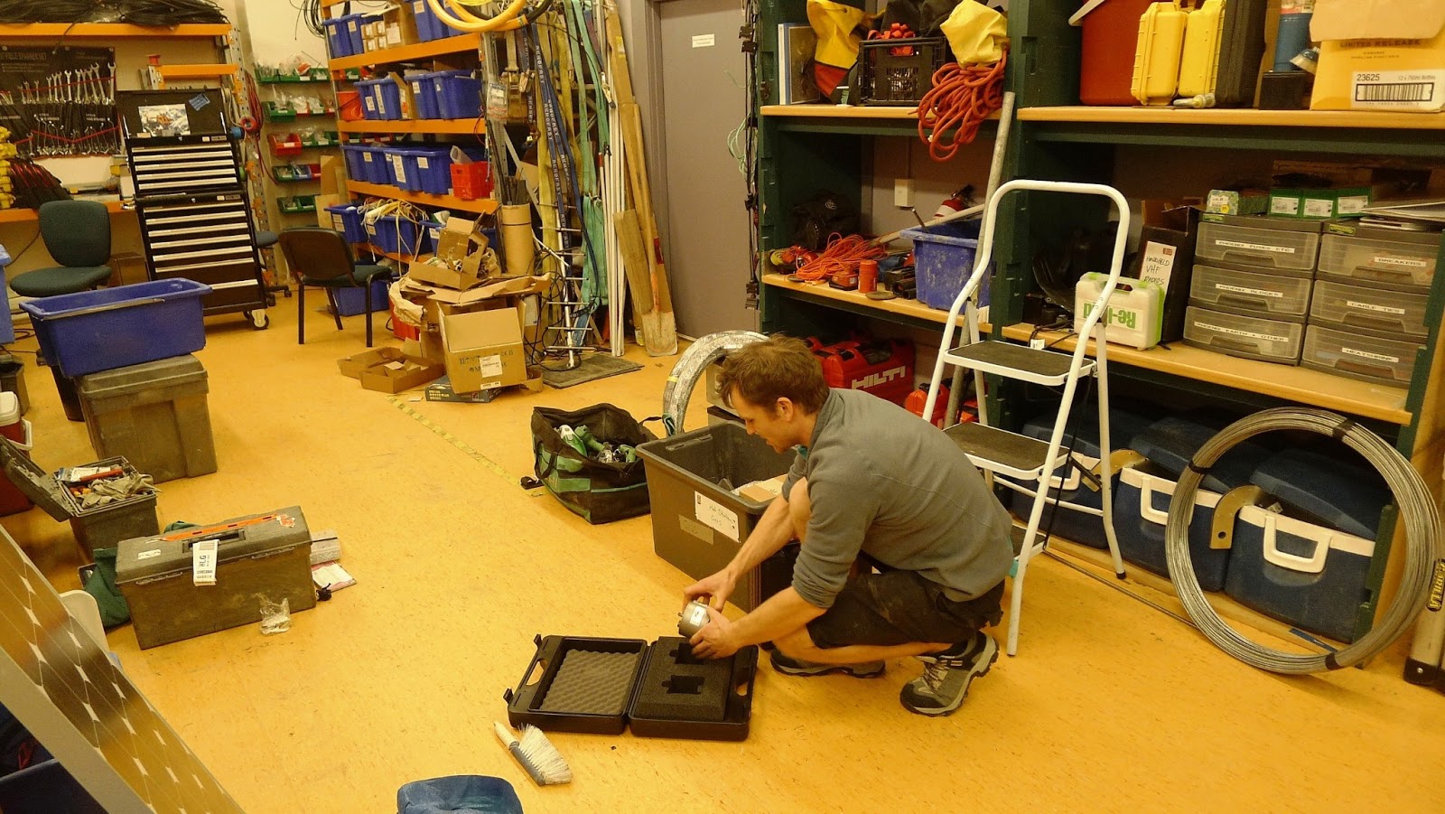
To help get more precise seismic data, the GeoNet fast response team are already in Marlborough, setting up some extra temporary seismometers at carefully chosen locations to ‘fill in the gaps’ between existing permanent stations. Here is a photo of one of the team yesterday, packing one of the seismometers for the trip. To see more photos of what these guys do, have a look here.
This is a computer simulation of the seismic waves from the M6.5 ‘quake propagating across the North Island and the adjacent sea floor:
New Zealand’s background risk of earthquake probabilities has been calculated for the whole country. Once a reasonably large earthquake has occurred, these background risks of a larger quake increase for a while in the local area, and a sequence of aftershocks follows that typically fits into a fairly predictable pattern of decreasing intensity over time.
In the video below Matt Gerstenberger explains how these calculations are made to produce probability tables and maps for future aftershocks.
For the latest information about the number and magnitude of aftershocks that have occurred in Cook Strait, as well as forecast probabilities for future quakes, have a look at this GeoNet page
Hello do you know anything about the fault (if is a fault I don't know) that goes through Lyall Bay and Rongotai in Wellington? Like how deep down it is?
Image: http://i.imgur.com/MxM4QVo.jpg
This is awesome!