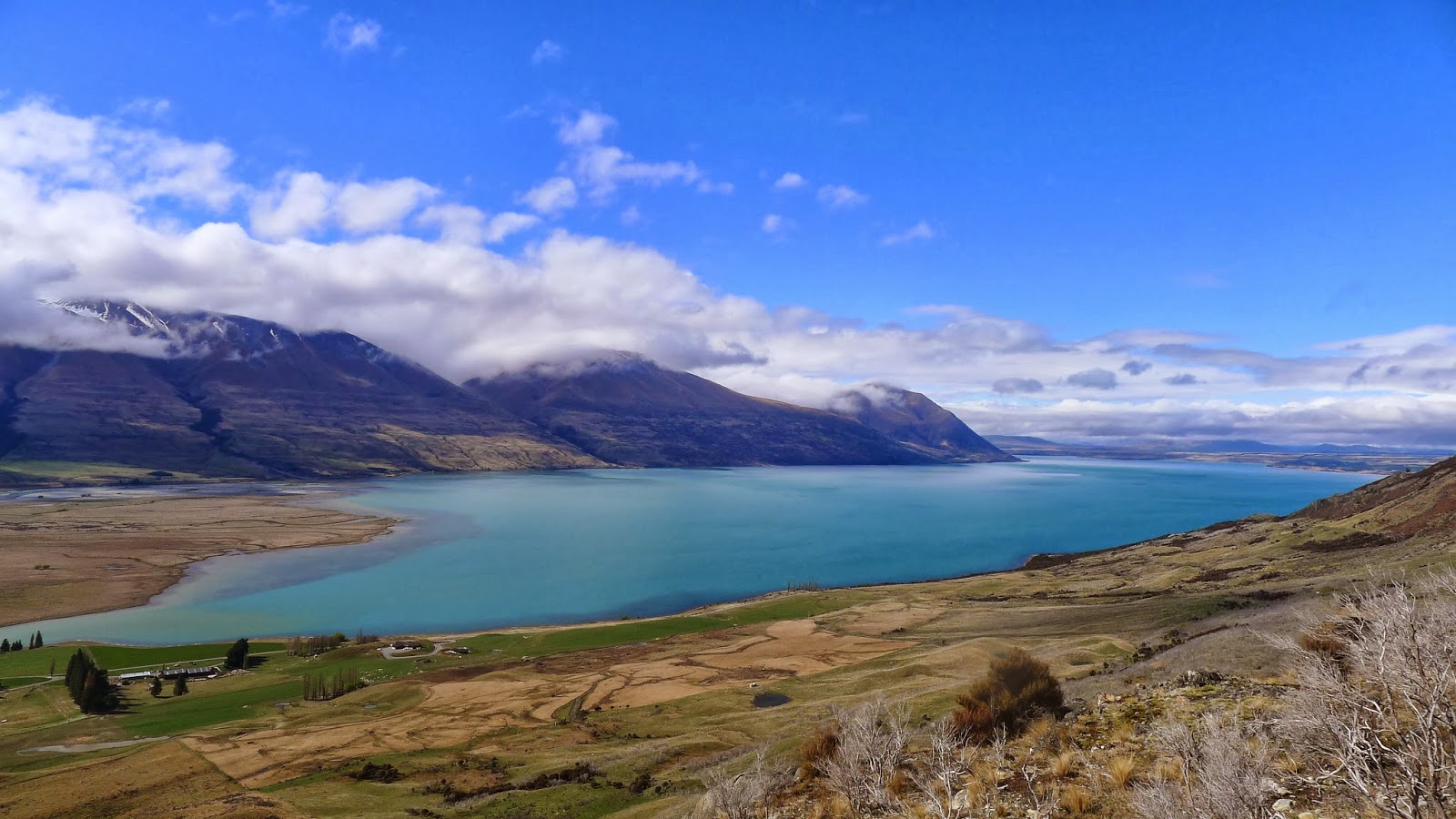
Ever since its creation by the retreat of a huge glacier at the end of the last ice age, Lake Ohau has been gradually filling up with sediments washed down from the nearby mountain ranges.
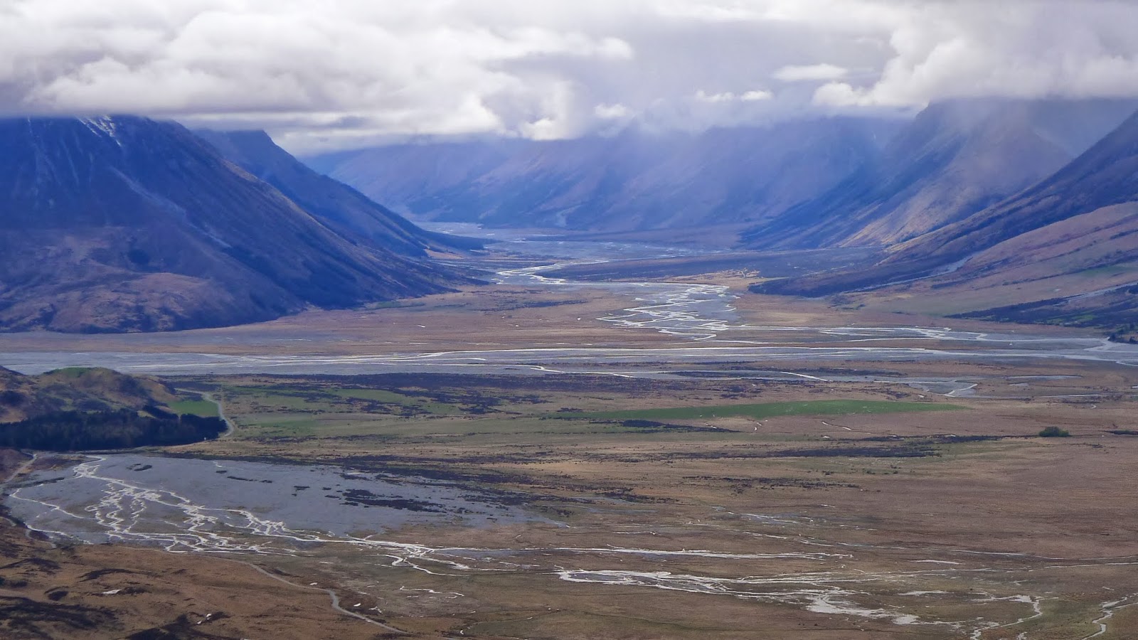

This is the view looking north from the lake, up towards the Dobson Valley. The valley profile has the classic ‘U’ shape created by glacial erosion, and the flat valley floor is blanketed by sediments brought down by rivers, especially during floods when the water flows with high energy.
Here you can see the lake inlet. You can see the delta created as the sediments fill the lake.
Lake Ohau has been receiving a high level of scientific interest over the last few years, by scientists from GNS Science in collaboration with others from Victoria and Otago Universities.
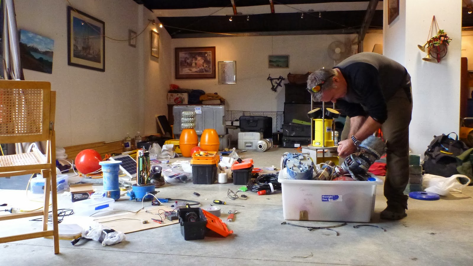 |
| Gavin Dunbar of VUW preparing equipment |
They aim to understand the processes of sedimentation in the lake, and work out how these processes relate to weather patterns affecting the catchment. With that information, a study of the lake floor sediments will potentially give a detailed record of how the climate has changed in the area over the last 18 000 years, since the lake’s formation.
A number of limnological (lake) measurements are being made to help understand the way water currents, water temperatures and water clarity vary seasonally in different parts of the lake. This is important because it allows for understanding of the factors that influence the deposition of mud on the lake floor.
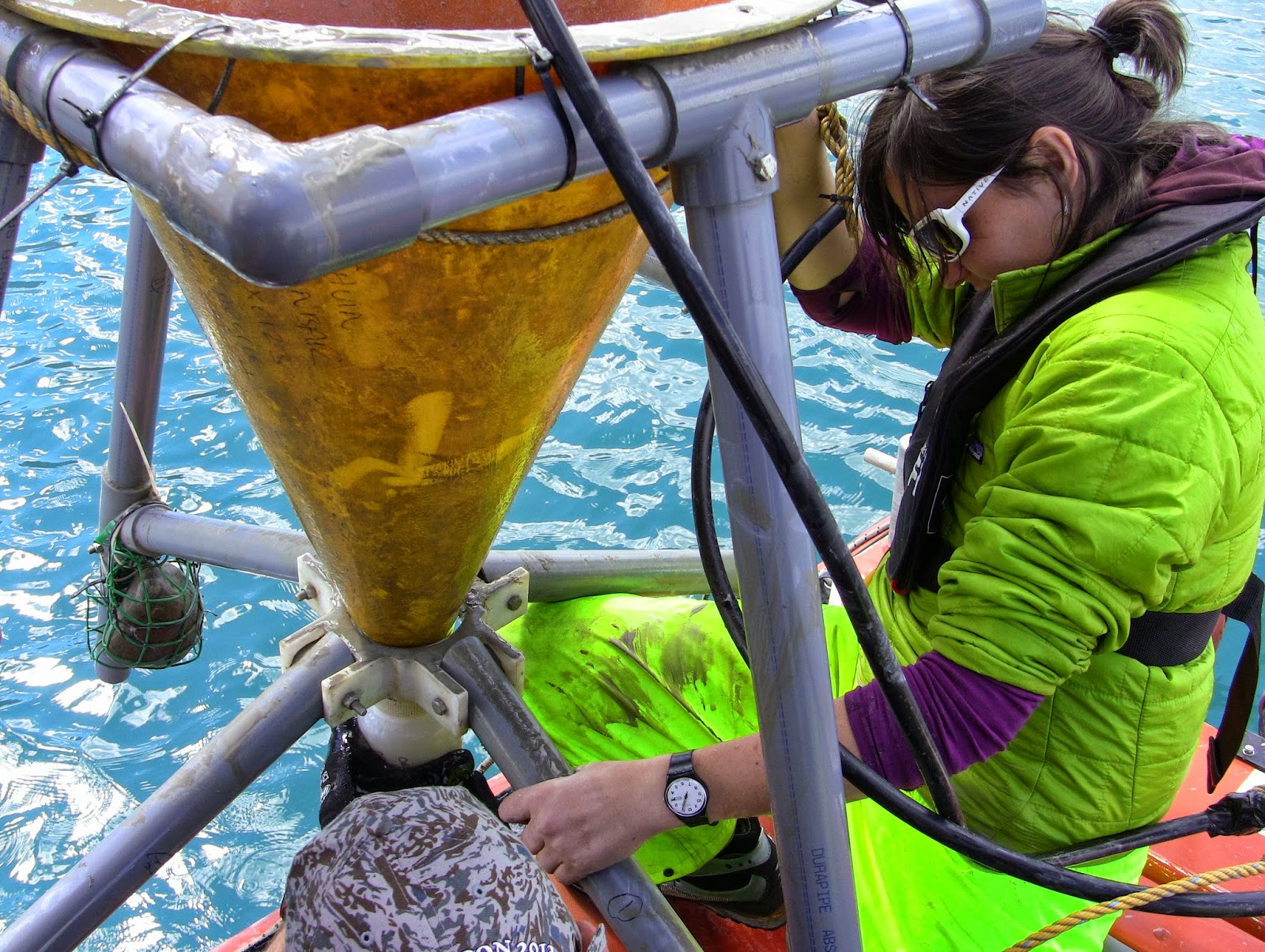
In this photo Heidi Roop (GNS Science PhD student) is helping pull a sediment trap out of the water at the end of the lake nearest to the outflow. At the bottom of the trap there is a bottle of sediments that have accumulated over the last 4 months.
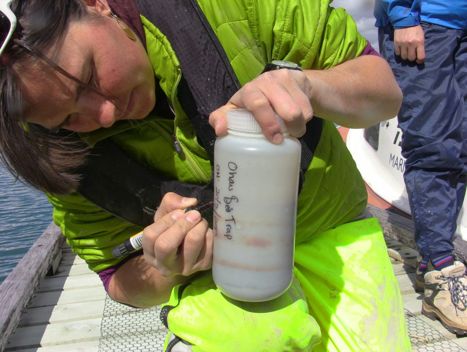
The 1 litre bottle is removed and replaced with an empty one. The bottle is quite full because it contains concentrated sediment that has fallen into the wide mouth of the trap. Careful recording is one of the most important parts of any scientific data collection.
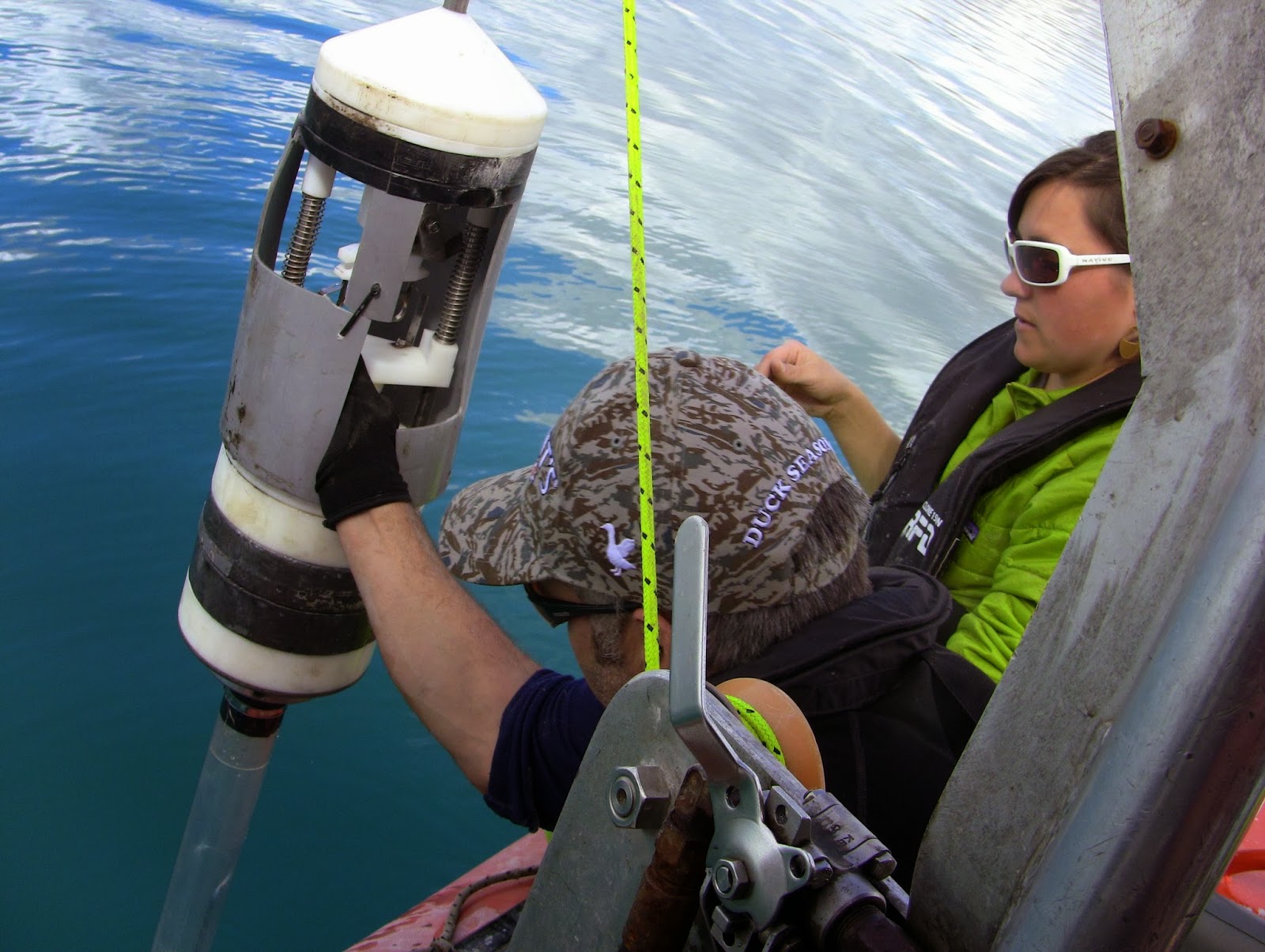
Marcus Vandergoes and Heidi Roop prepare to lower a gravity corer into the lake to sample a small core of the top layers of sediment. As the corer penetrates about 25cm into the lake floor, the mud enters the plastic tube. A cap then seals the top end of the tube so that the mud is held in place by a vacuum as the corer is pulled back up to the boat.
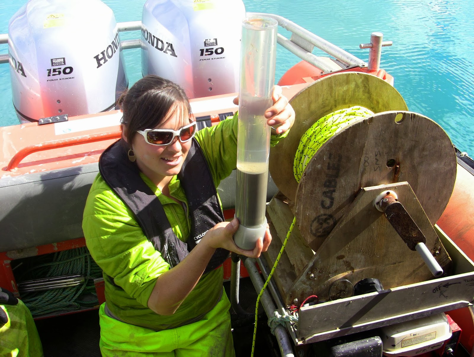
Once at the surface, the lower end of the tube is sealed to prevent loss of the core which is then prepared for transport back to the lab for close study of the different layers, including thicknesses of the different layers, grain size and density.

Heidi and Marcus pulled up a second core to show me what can be seen when it is sliced through to show a flat surface. Darker and lighter layers are visible, which have been shown to correlate with summer and winter deposition. The thickness of each layer is thought to be related to the number and size of storms and flood events. This core includes sediment accumulated over the last 25 to 30 years.
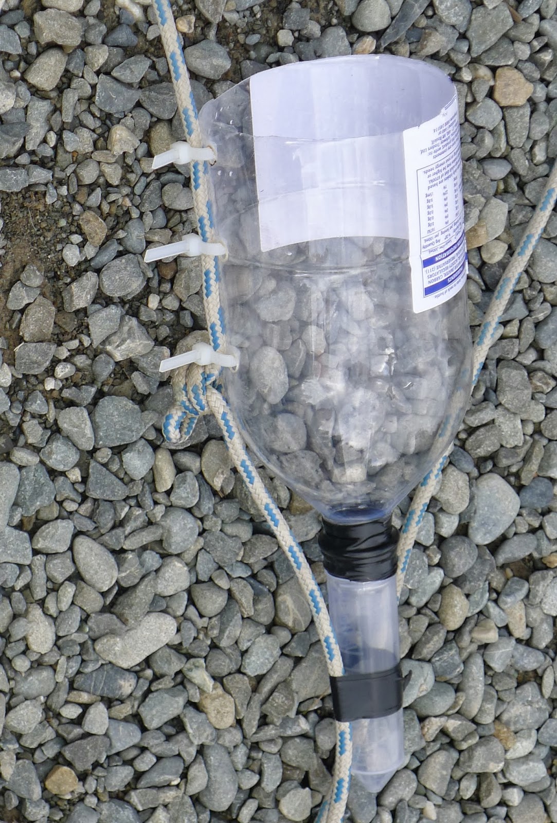
Heidi has devised a way of comparing the sedimentation of particles from different depths in the lake water at each end of the lake. She has a line with several upside down cut plastic bottles that act as mini sediment traps attached at different levels in the water column. This shows whether the currents that deliver sediments to the lake are flowing at the surface, the bottom, or at intermediate depths. It turns out that this varies between summer and winter. In summer, the warm water entering the lake carries the sediment load at a high level, whilst in winter, the particles travel along with cold bottom currents. This is why the summer and winter layers of sediment have different physical characteristics.

Clear as mud – a successful day’s sample collecting from Lake Ohau,