 |
| K-Pg boundary layer – when the Earth changed forever |
The K-Pg Boundary (or Cretaceous Paleogene boundary, or K-T boundary as it is still sometimes called) is a layer in the Earth’s crust that marks a very dramatic moment in the history of life on earth about 65 million years ago. There is a huge change in the fossil communities of plants and animals across this boundary. Over half the species that are found in Cretaceous rocks are missing from the younger Paleogene rocks above them. Included amongst the creatures that vanished forever at this precise point in time are the ammonites, large marine reptiles (such as mosasaurs and plesiosaurs), large flying reptiles and of course the dinosaurs.

New Zealand has a unique record of the K-Pg boundary. These eight localities in the northern South Island provide the only Southern Hemisphere record of how the catastrophe affected land plants (Moody Creek Mine) and marine life (Waipara River and six localities in near Blenheim).
 |
| An artists image of the impact by Don Davis of NASA |
 |
| The dark line of the K-Pg boundary at Chancet Rocks |
 |
| K-Pg boundary at Chancet Rocks centre left of photo |
At Chancet Rocks, just north of Ward Beach, the light coloured Cretaceous limestone contrasts with the darker grey Paleocene rocks on the right side of the photo. These rocks were laid down in several hundred metres of sea water, and the fossils found within them are mostly microscopic unicellular plants and animals. These have been studied in detail and are very different assemblages.

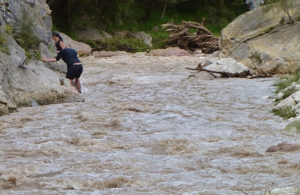
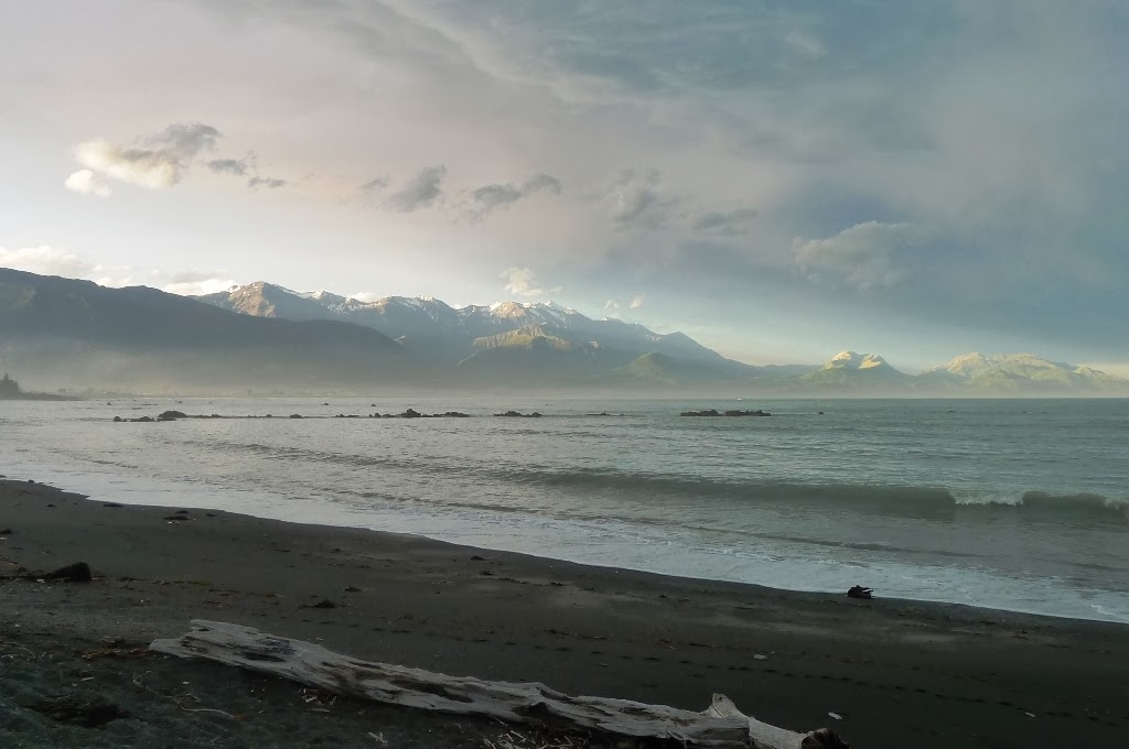
We also visited Woodside Creek, the first K-Pg boundary locality in New Zealand that was found to be enriched in iridium. Here you can see that the river was quite high, making access a little bit difficult.
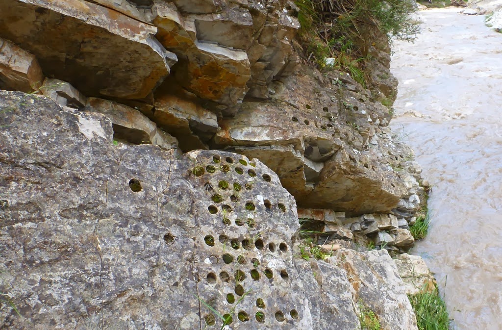
This is a close up view of the very top surface of the Cretaceous at Woodside Creek, just beneath the iridium rich boundary clay. The masses of tiny pock marks in this surface are thought to have been caused by droplets of glassy impact ejecta raining down onto the sea floor from high in the atmosphere after the impact thousands of kilometres away.

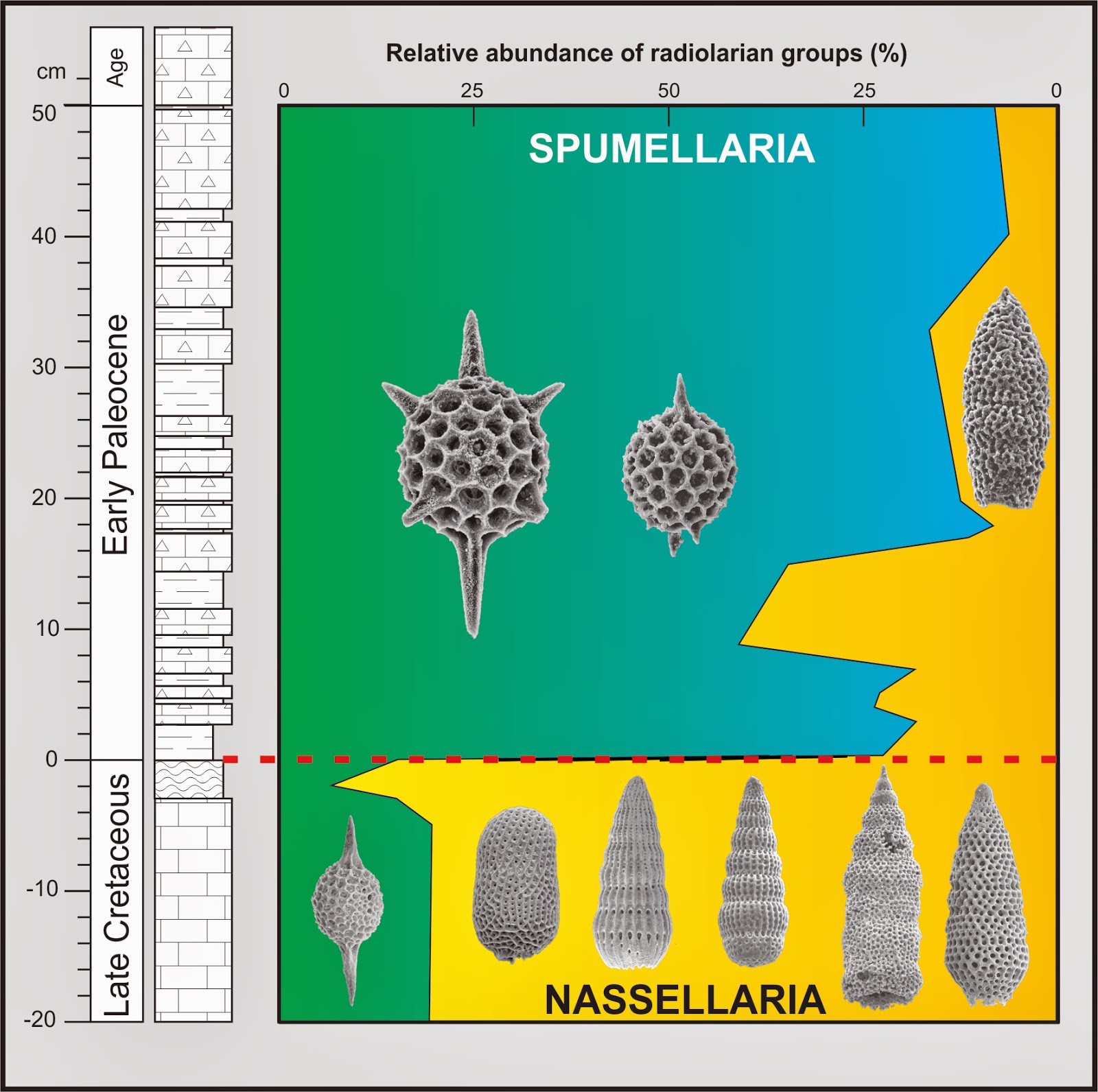
These microfossil changes are clearly shown in rock samples from the K/Pg section at Flaxbourne River, where over the distance of a few millimetres one group of radiolarians (nassellarians) are almost completely replaced by another group (spumellarians). This change is thought be a consequence of rapid cooling of the ocean waters around New Zealand.
In this video Chris tells us about the Woodside Creek K-Pg boundary section:
Very interesting thanks for posting this material. We went and had a look for the KT boundary at Manurewa Point and Awheaiti Stream at Tora on the Wairarapa Coast – not quite sure what we were looking at but fascibating stuff
Best wishes
Joe Howells
I'm gobsmacked. An old, non-science but curious person I had just read the New Yorker story about a site in N. Dakota. The story was by Douglas Preston, about Robert De Palma, and was the first time I'd read about the KT boundary. It unfolded like a detective story and led me to Google to see what what we had here in New Zealand – I'm in Christchurch.
So much to know! Thank you
Can anyone tell me the exact location of the K-Pg Boundary at Manurewa Point on the Wairarapa East Coast? I have looked at a location close to the high tide level on the northern aspect and there appear to be two likely layers – one a broad band of dark material with a thin layer in the middle at the high tide line and another hinner band higher up
there is a mega tsunami deposit at Tora… Chris Hollis discusses: https://youtu.be/3RI1QtF-Tuk