
This is a classic view of the Southern Alps from Lake Matheson on a still morning, showing the high peaks of Mount Tasman and Mount Cook.
The Alpine Fault runs along the foot of the steep rangefront, extending right up the West Coast of the South Island. The mountains are therefore part of the Pacific Plate and all the flat land in front, made up of glacial outwash gravels, is on the Australian Plate.

This graphic shows the Alpine Fault as a very distinct line dividing the high mountain topography to the East and from the coastal lowlands along the West Coast. Arrows show the horizontal directions of fault ruptures along the fault, but there is also a vertical component that is pushing up the Southern Alps.
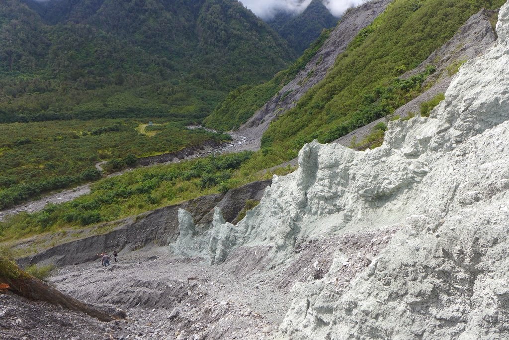
At Gaunt Creek near Whataroa, you can get right up close to a cliff exposure of the Alpine Fault. The pale green rocks in the foreground have endured being crushed and uplifted along the fault line. They have been altered into what is known as cataclasite, consisting of clay and lots of crushed rock fragments.You can visit this location by checking out our GeoTrips website here: www.geotrips.org.nz/trip.html?id=57
The low angled line of the Alpine Fault is very distinct on the right side of the photo, with the metamorphosed cataclastic rocks that have been uplifted from kilometres down in the crust being pushed over the much younger gravels to the West (right).
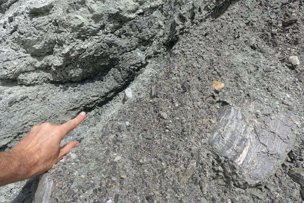
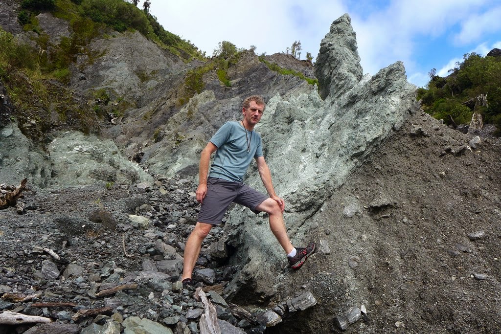
You really can put your finger on New Zealand’s plate boundary here! The Pacific Plate is on the upper left, thrust over ice age gravels of the Australian Plate on the right hand side of the image. The photo gives a good impression of the nature of the crushed rocks.

 A more distant view of the cliff section from the creek shows how the uplifted rocks have over-ridden the gravels which are about 15 to 16 thousand years old. The two white arrows show the line of the fault.
A short distance away is the Deep Fault Drilling Project (DFDP1) Observatory that was set up after two boreholes were drilled here in 2011. The fault is dipping at about a 40 degree angle, and the boreholes were positioned to intercept it at around 100m depth.
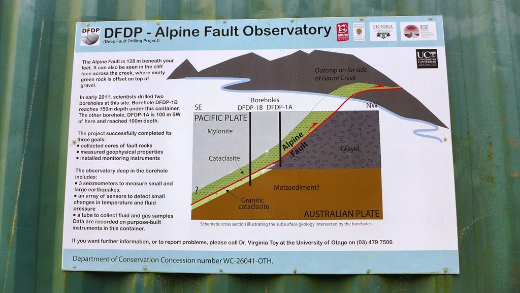
Instruments down the boreholes include seismometers and other sensors that have been installed to better understand the physical conditions along the fault as it extends down below the surface.
For a bit more background to the DFDP have a look at this previous post from 2011