 The Wairarapa Fault is one of New Zealand’s large active faults running along the eastern edge of the Rimutaka range from Palliser Bay north into the Wairarapa. It was responsible for the massive magnitude 8.2 earthquake that violently shook the lower North Island in 1855 in New Zealand’s largest historically recorded ‘quake.
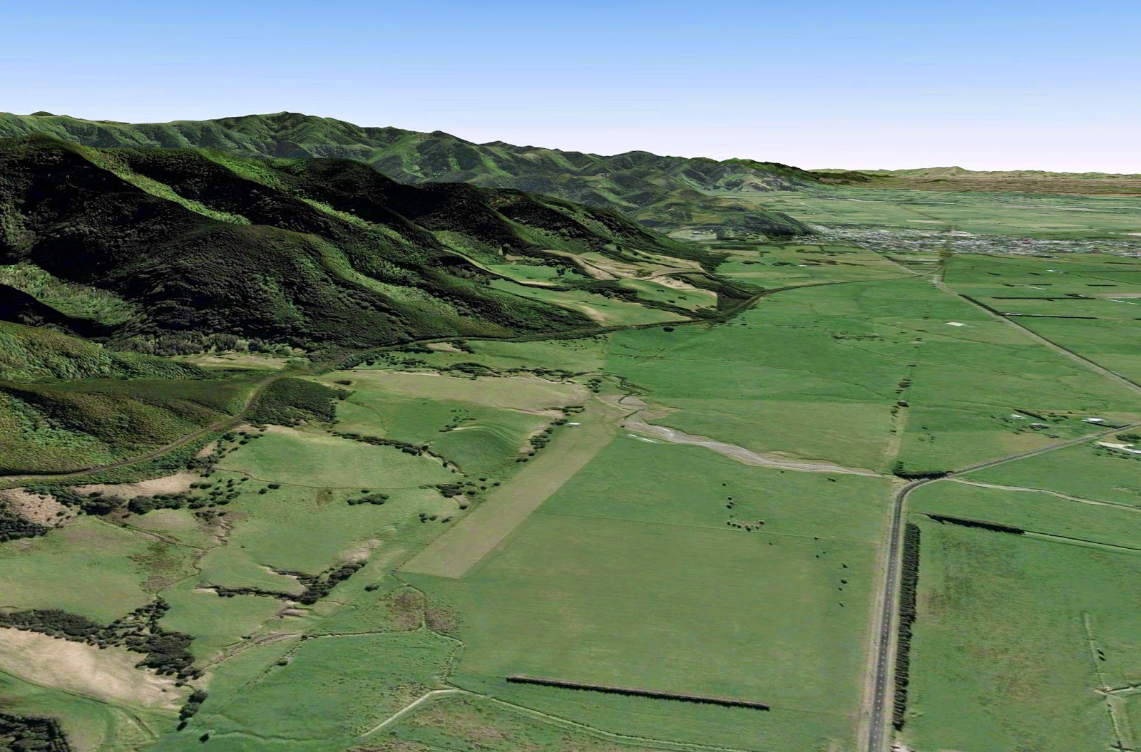
This Google Earth view shows the surface trace of the fault, with the Rimutaka Range to the west and the Tararuas in the distance. An interesting location called Pigeon Bush is indicated by the red circle. It is about 50 kilometres north-east of Wellington City.
 |
| Photo Andrew Boyes / GNS Science |
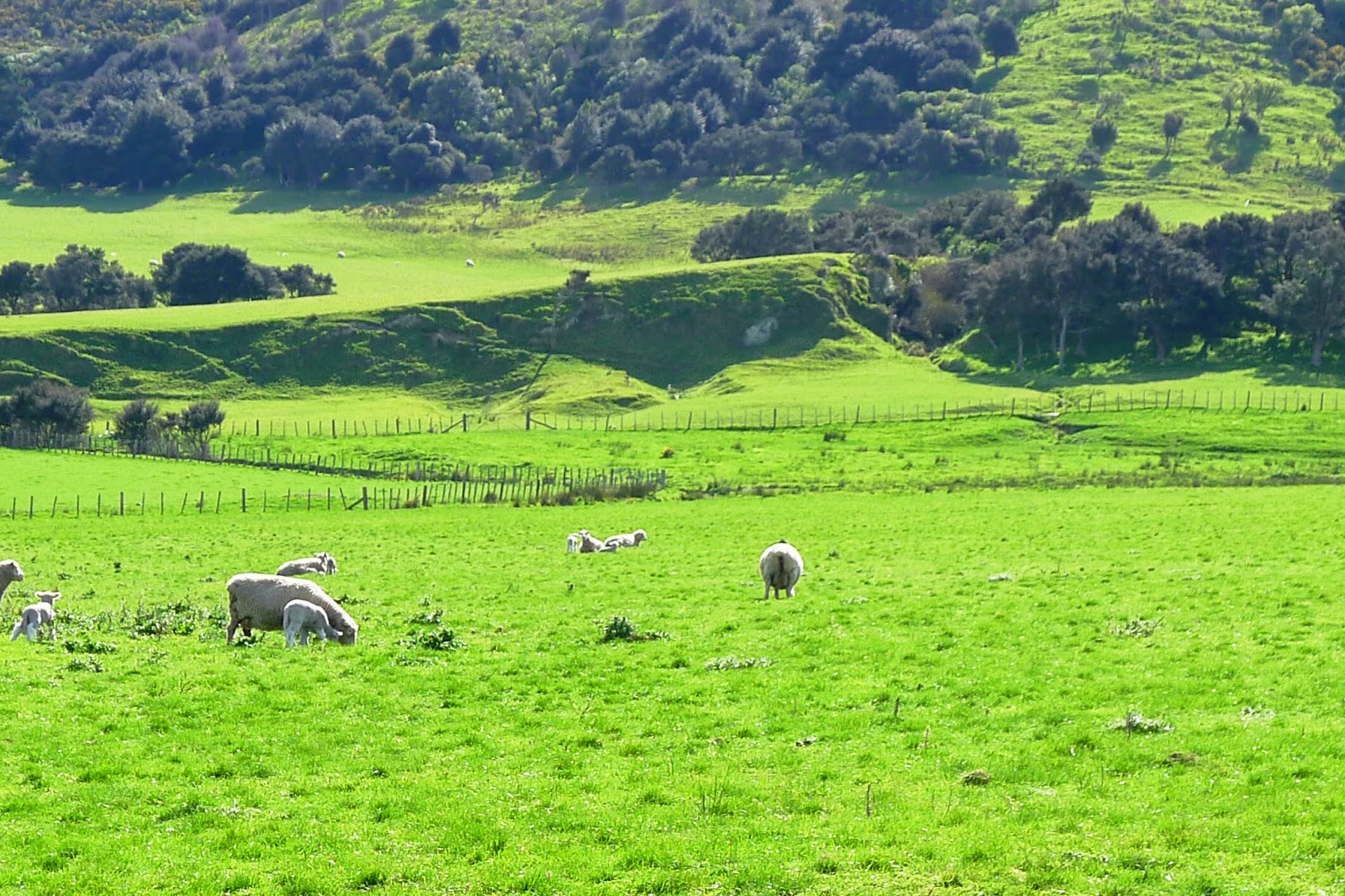
The second photo is a view of the Pigeon Bush locality from the nearby road, showing a steep scarp uplifted by earthquake ruptures of the fault. The fault itself runs along the base of the scarp, which is the product of several earthquakes over the last few thousand years.
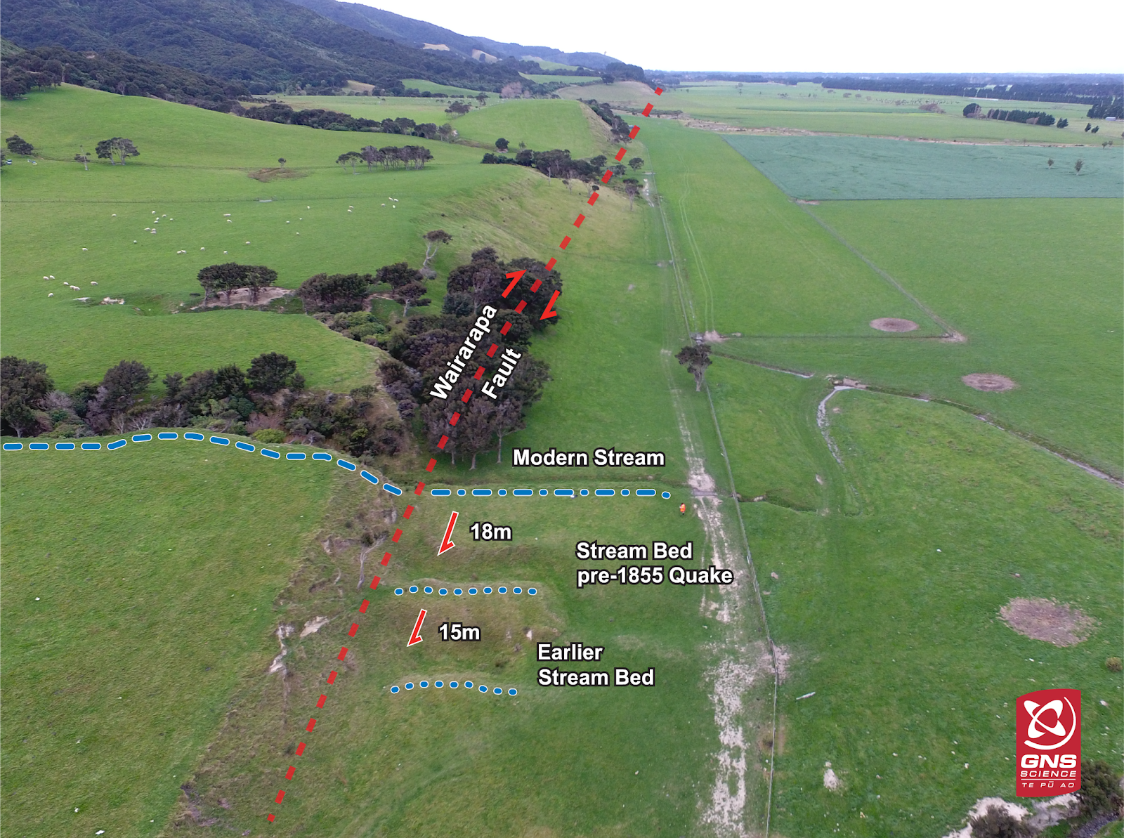
A close up view shows some interesting features beside the fault scarp. Two stream channels (middle and foreground of image) appear out of the scarp, with no sign of any catchment gully above them. Meanwhile a bit further along (where the trees are) you can see that there is a deep cut gully in the scarp itself.

Geologists have long recognised that the stream that created the two small ‘beheaded’ channels has been shunted along horizontally by the last two ruptures of the fault.

In this photo, Rob Langridge, an earthquake geologist from GNS Science, is standing between the first (most recently beheaded) stream channel on the left, and the vegetated gully that was originally connected with it on the right. Some idea of the amount of offset that occurred in the 1855 earthquake can be appreciated from the image. There would also have been some uplift during that earthquake of perhaps one or two metres at this location.

We used a tape measure and recorded the distance along the fault between the centre of the now separated stream gullies, and came up with a figure of about 18 metres. This huge displacement is the largest offset to have been caused by a single earthquake on a land based fault known from anywhere in the world. (It is now known that subduction earthquakes such as the great 2011 Tohoku Earthquake of Japan can produce even greater displacements of the ocean floor)

We also measured the offset of the older stream channel which was about 15 metres away from the first beheaded channel.This previous earthquake is thought to have occurred about 1000 years ago. The average repeat interval for ruptures of the Wairarapa Fault is thought to be about 1200 years.
 |
| Offset stream channels at Pigeon Bush, A Boyes / GNS Science |
Here is an image taken using a drone and annotated by Andrew Boyes at GNS Science:
 About 45 kilometres north of Pigeon Bush it is possible to see a view of the fault itself in a cutting of the Ruamahanga River near Masterton. In the photo you can see how older grey rock on the right (west) have been pushed up relative to the younger gravels on the left (east) in a reverse fault. The substantial horizontal movement may also have caused this juxtaposition of older rocks against younger ones.
Here is another view of the fault where it is known as the Wharekauhau Thrust in a cliff section at Thrust Creek on the Palliser Bay coast. Royal Society Teacher Fellow Phillip Robinson is inspecting the older shattered greywacke rocks that have been thrust over the gravels from the west (left), tilting the relatively young 50 000 year old gravel layers from a horizontal to a vertical orientation.

This is the view looking south from Thrust Creek along to the southern tip of the Rimutaka Range, with Turakirae Head in the far distance. During the 1855 earthquake, a maximum of 6 metres of uplift occurred along this coast. A 10 metre high tsunami also swept along this coastline. Check out this previous post to learn about the amazing uplifted beaches at Turakirae Head.
Note that you can now find out how to visit Thrust Creek (and many other geology locations) on our GeoTrips website here: https://geotrips.org.nz/trip.html?id=255
This is a very interesting account of an earthquake that does not get much mention in the media, and which the vast majority of the public would know nothing about.
I had a book which I think I must have sold, called "Magnitude 8.2 – …" (can't remember the whole title or the author), which described the earthquake, the secondary events such as the tsunami, the aftershocks and notable landslide events. Apparently there were 15 aftershocks stronger than magnitude 6.0 and seiching as far away as Kaikoura.
A second hand book dealer might have it, but sorry that I can't remember more of the title or the author.
Cheers,
Rob
"Magnitude Eight Plus New Zealand's Biggest Earthquake",by Rodney Grapes, Victoria University Press, 2000
ISBN 0 86473 340 2
J.Law
Very interesting – we are amateur people with an interest in geology from Martinborough and have had a good look at the mentioned sites and there are two things that we would like more information on – the first is the material overlaying the gravels on the track up Thrust creek appears to be quite soft and dark mudstone – this seems to be the material between this point and the graywake of the Rimutaka ranges that comprises the Wharekauhau Thrust? – where has this come from? It looks like comparatively recent lakebed or seabed material? with some organic content?
The second thing we would like more informatuion on is the west Wairarapa fault trace noted on the blog – we had a good look at it when it meets the ocean south of where the road crosses it at Wharepapa station buildings – why is the eastern side of the fault raised above the western side by many meters – when further north it is the western side of the fault that is raised?
This is obviously an really interesting geological area!
Best wishes
Joe Howells