 |
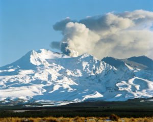
| Ruapehu Eruption, Image: Lloyd Homer@GNS Science |
Ruapehu is very popular with skiers, trampers and other adventurers. As an active volcano with the potential for sudden eruptions through its crater lake, Ruapehu presents the Department of Conservation with a significant hazard management issue.
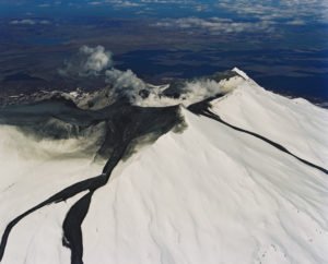 |
| Lahars on Ruapehu: Image: Lloyd Homer@GNS Science |
Obviously there is the possibility of people in the vicinity of the summit area being immediately affected by water, rocks and ash thrown out by an eruption. An additional hazard is that displaced water and sediment from the crater lake can mix with snow and loose volcanic material to create fast moving mudflows (lahars) which descend rapidly down valleys radiating away from the summit.
The collapse of the crater wall can also cause a lahar to flow down the Whangaehu Valley to the east of Ruapehu, independently of an eruption. It was this type of lahar that caused the railway tragedy at Tangiwai in 1953.
This video explains the basics of lahars at Ruapehu and the two ways they can be created:
 |
| Image Graham Leonard@GNS Science |
Not surprisingly, due to the high number of mountain users, the lahar hazard has been studied in detail and measures put in place to give warnings and reduce the potential impact on people and infrastructure. This has involved a close collaboration between GNS Science (GeoNet), the Department of Conservation and Ruapehu Alpine Lifts who run the ski areas.
First of all, regular monitoring of the crater lake’s physical and chemical properties is carried out by GNS volcanologists as part of the GeoNet project. This alerts them to changes of activity within the volcano:
This information helps the GeoNet team to set the volcanic alert level for the mountain, which is important for a number of agencies such as the air industry, Regional Councils, local businesses and others.
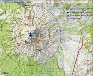
Because of the potential for some eruptions to occur with little or no warning, and the speed with which lahars travel down the slopes, there is also an Eruption Detection System (EDS) in place. This is triggered when both ground-shaking (seismic waves) and an air blast are detected within a short time of each other at a number of monitoring stations throughout the Tongariro National Park.
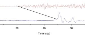
This image shows the arrivals of volcanic earthquake tremors (top) and the air blast (bottom) of an eruption, at a station about 9 kilometres from the crater lake:
You can see that there is a time lag of about 30 seconds between the onset of groundshaking and the arrival of the air blast at the same station. The EDS system has been developed by GeoNet and is unique in the world.
A detected volcanic eruption will automatically set off the Lahar Warning System, consisting of loudspeakers that warn people in the ski areas to get out of valleys that could be affected, and onto high ground nearby.
This video describes the system that has been set up to protect skiers on the mountain and how it is tested for its effectiveness:
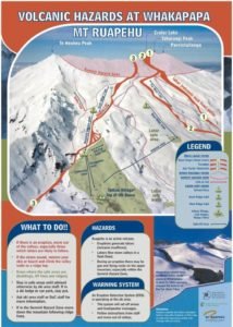
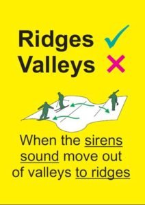
There is also a lot of information displayed visibly at key points in the ski areas and surrounding facilities and communities to explain the lahar hazard, and what to do or not to do if a warning alarm is sounded:


Hi Julian,
My name is Jude Sneddon, you might have heard about me from Deborah Maxwell. Me and my group are from worser bay school in miramar. I got forwarded the email you sent to deb, and I have some questions to share.
How do earthquakes affect people?
Where do earthquakes strike the most?
How are earthquakes measured?
What are tectons?
Can earthquakes affect everywhere?
What has been the biggest local earthquake?
What do we do to be prepared?
What are people doing to help?
How do earthquakes affect wellington?
I can email back for a time and date.
Thanks,
Jude.
Hello, i really enjoyed this video and this post, this is such great stuff that you have shared here, had a good time reading it. So much appreciated. Keep it up.
Fascinating and insightful post! 🌋 It’s incredible to see how advanced monitoring systems and safety protocols are protecting people around such a powerful natural force. The coordination between science, technology, and preparedness is truly inspiring. As a team offering Electrical Installation Services, we really appreciate how critical reliable power and communication systems are in such environments — ensuring safety, alerts, and monitoring all work seamlessly when it matters most. ⚡👏